
Have you ever wondered why the sign for the El Sueno Road exit on the northbound 101 doesn’t have a tilde over the n? In Spanish, sueño means “dream,” while sueno doesn’t mean anything at all. My housekeeper, a native Spanish speaker who lives in Goleta, said that the road is pronounced as if there’s a tilde, like in jalapeño, and that the sign has a tilde on it. When I insisted there’s no tilde, she looked at me like I was crazy. But there’s no tilde! Not on Google Maps, either. All of which is to say that I’ll write it as El Sueno, but I’ll pronounce it otherwise.
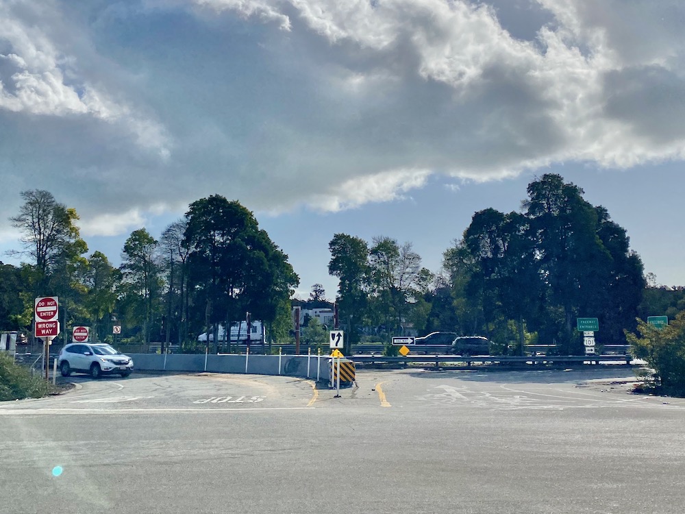
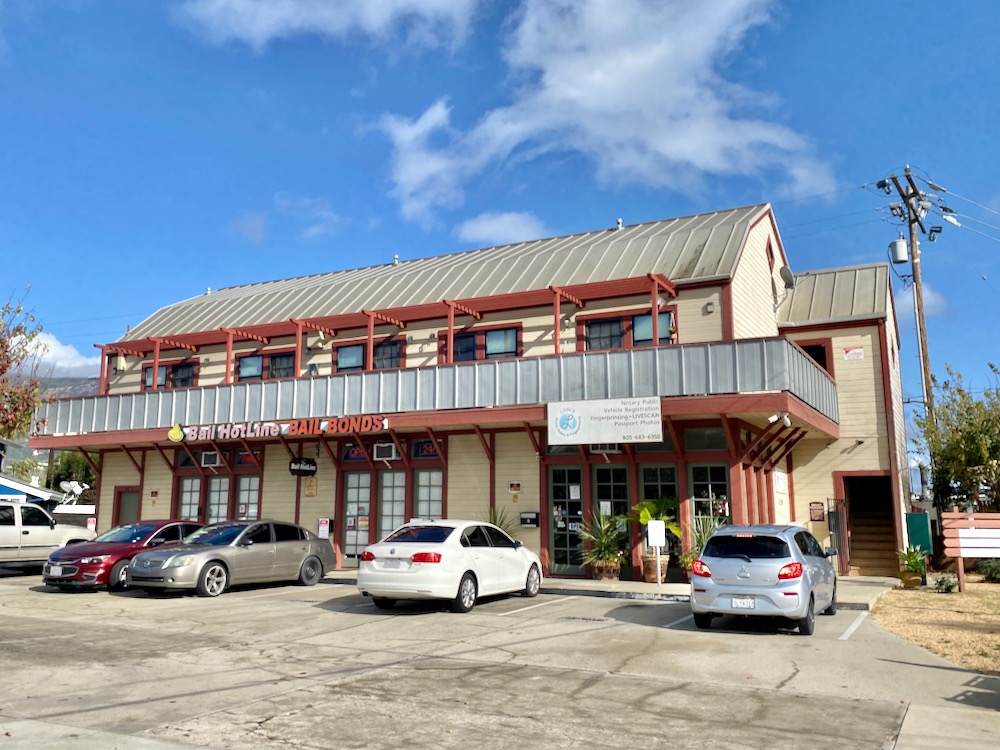
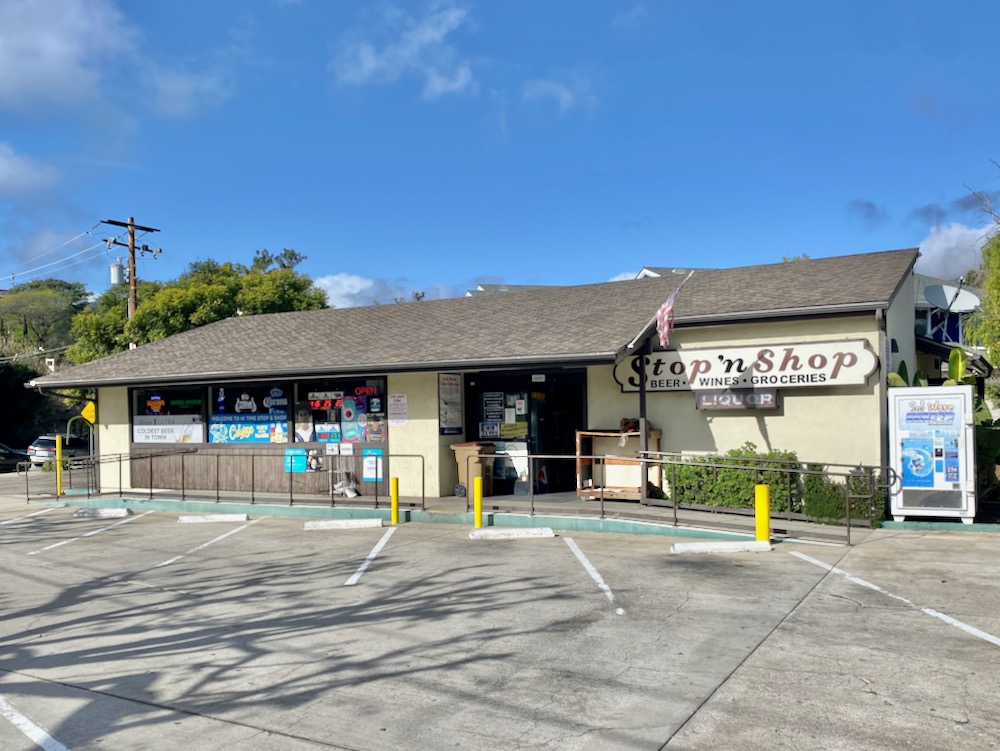
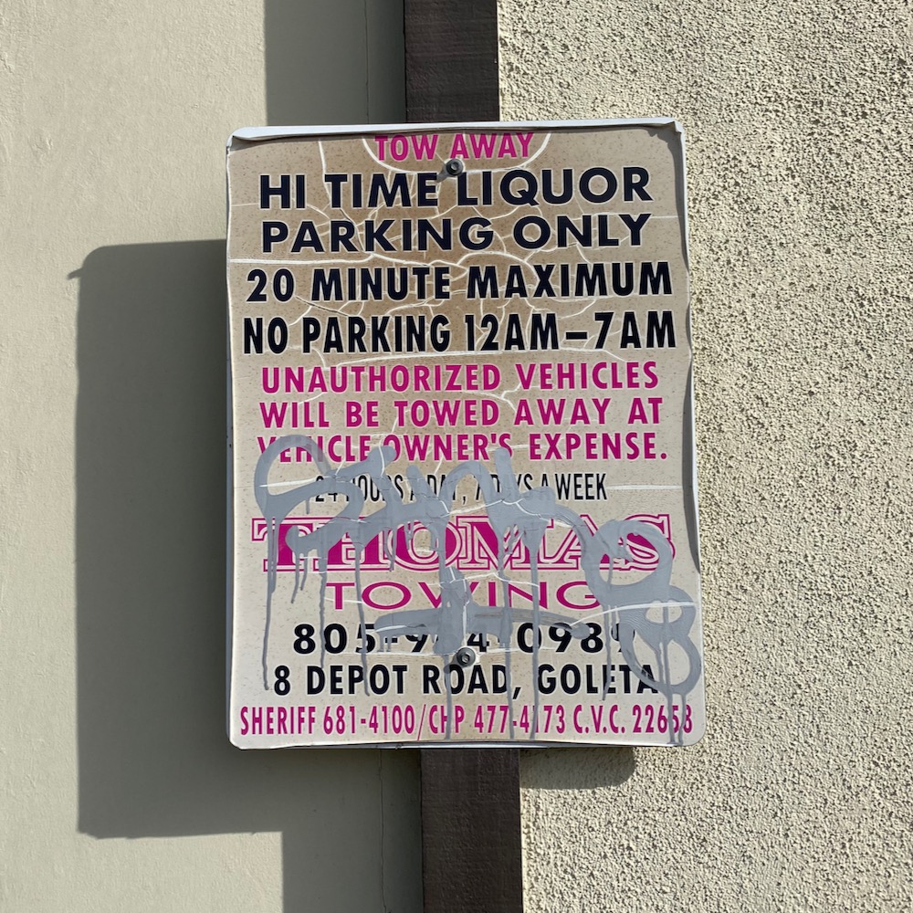
 There’s something old-school about the on- and off-ramps, which I’ve never had reason to use before, probably because there aren’t many businesses nearby, with the exception of a bail bonds office and a convenience store. The main sign for the latter calls it the Stop ‘n Shop, but ancillary signage refers to it as Hi Time Liquor, an exponentially more exciting name. (The internet says Hi Time Liquor #1 is on S. Fairview, and Hi Time Liquor #6 is on Calle Real. Perhaps this used to be the site of Hi Time Liquor #2, #3, #4, or #5?) Growing up in Huntington Beach in the 1970s and 80s, my friends and I used to hang out at a liquor store because it had video games. I imagine the state doesn’t allow that anymore.
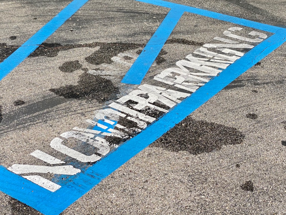
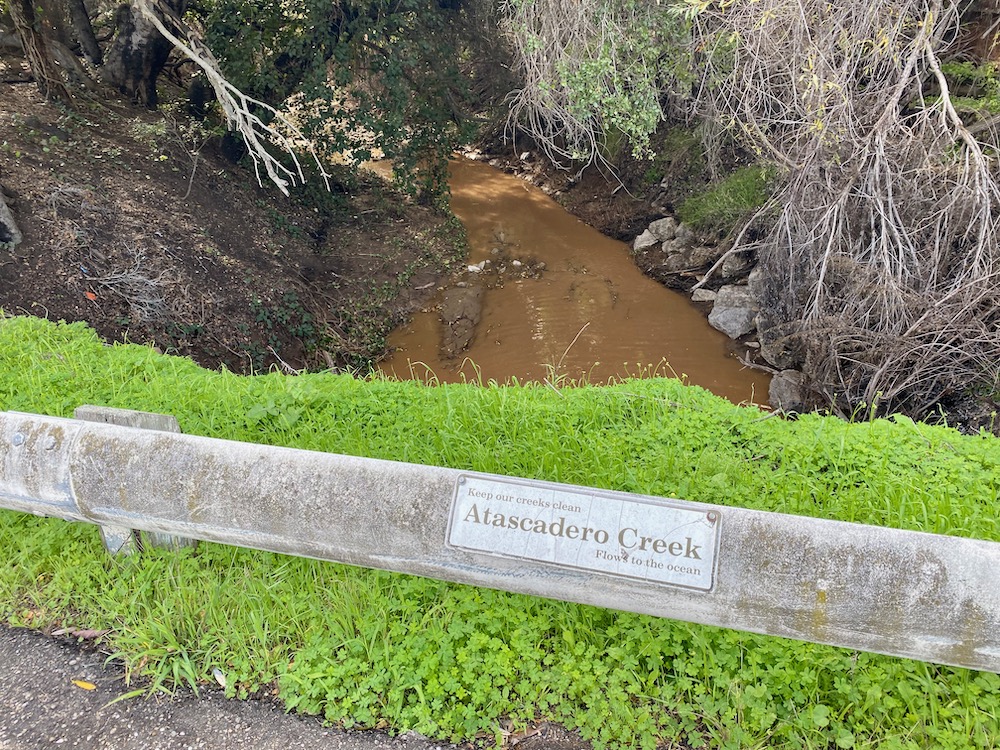
 This is where the no-nos go.
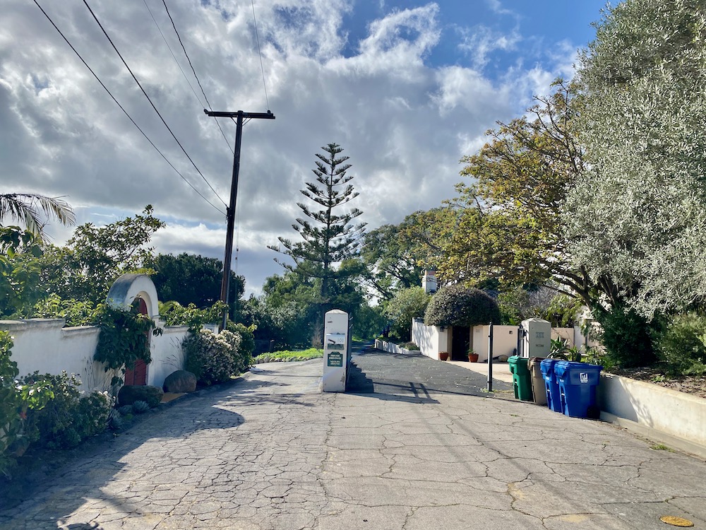
 El Sueno Road doesn’t have all that many houses on it, and it doesn’t even go through (for cars) all the way to Cathedral Oaks, so how does it justify an exit? I suspect that the predominant users are the residents of the mobile home parks to the east and that the road is blocked to stop people from taking El Sueno to the county offices on Cathedral Oaks.
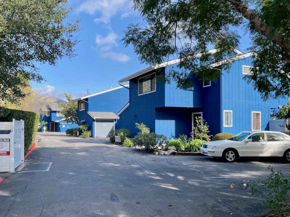
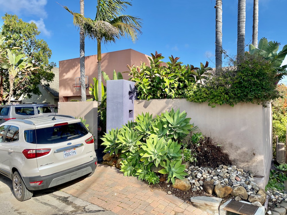
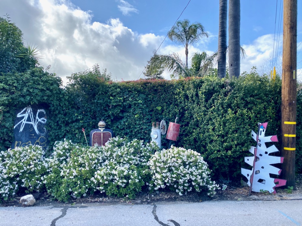
 The El Sueno Condominiums verge on Smurf blue.
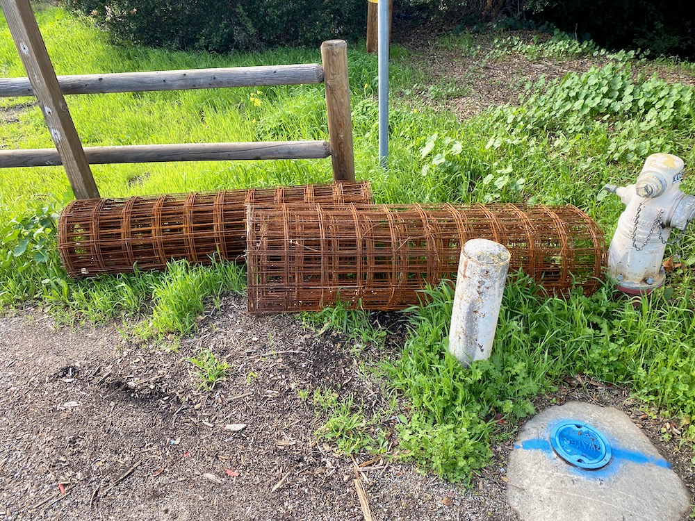
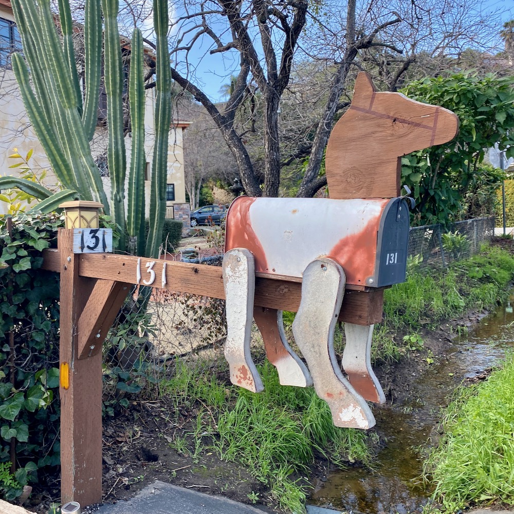
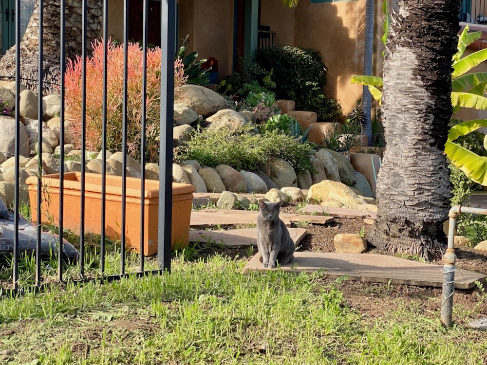
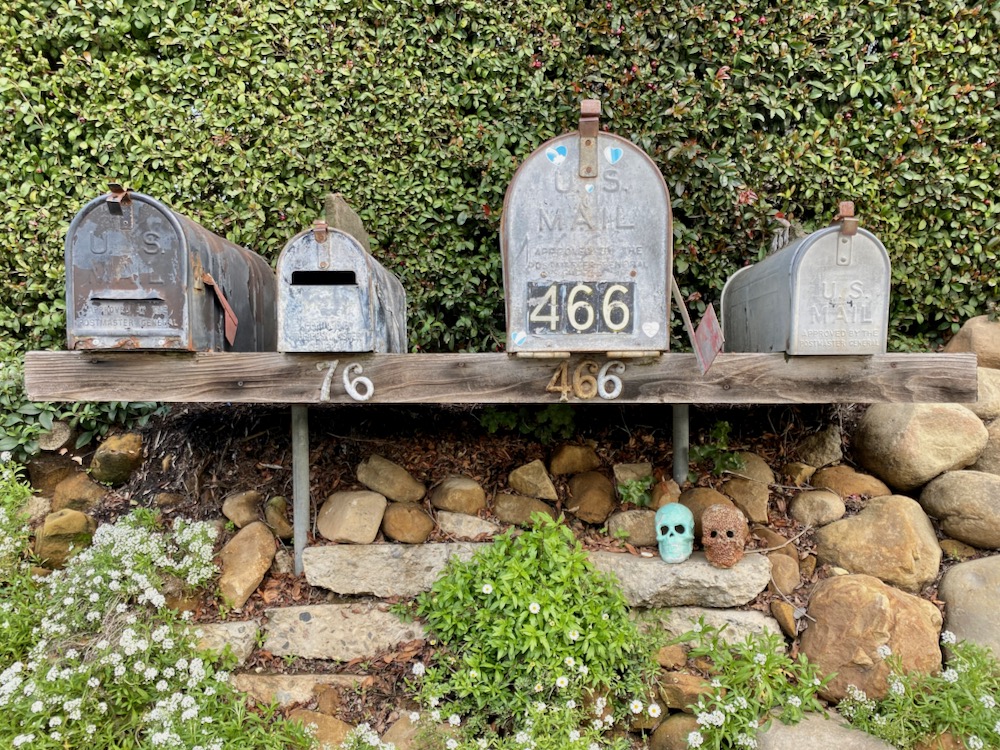
 The walk had a rustic feel from the get-go: rusty detritus, a creek crossing, no sidewalks (or even much of a shoulder), and a mailbox shaped like a
 horse dog llama animal.
 That’s one building.
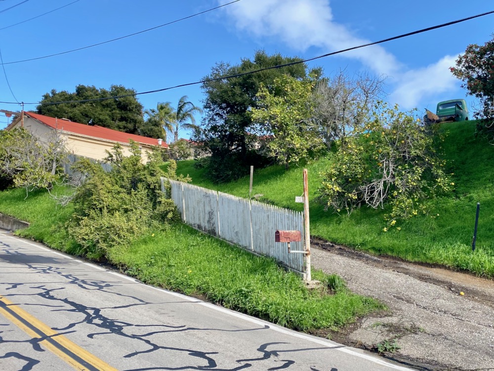
 My scant pre-trip research didn’t prepare me for the uphill part at the start; if it weren’t too late to make a New Year’s resolution, I’d resolve to tackle more hills. The bucolic scene of an old truck and picket fence in need of painting helped take my mind off of the trudgery.
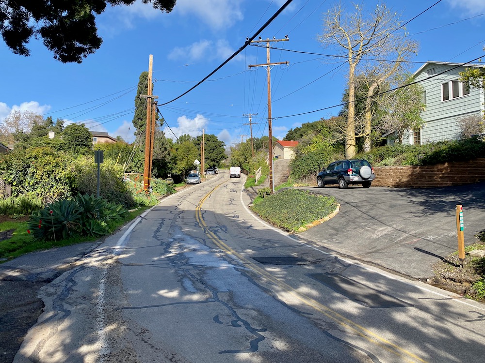
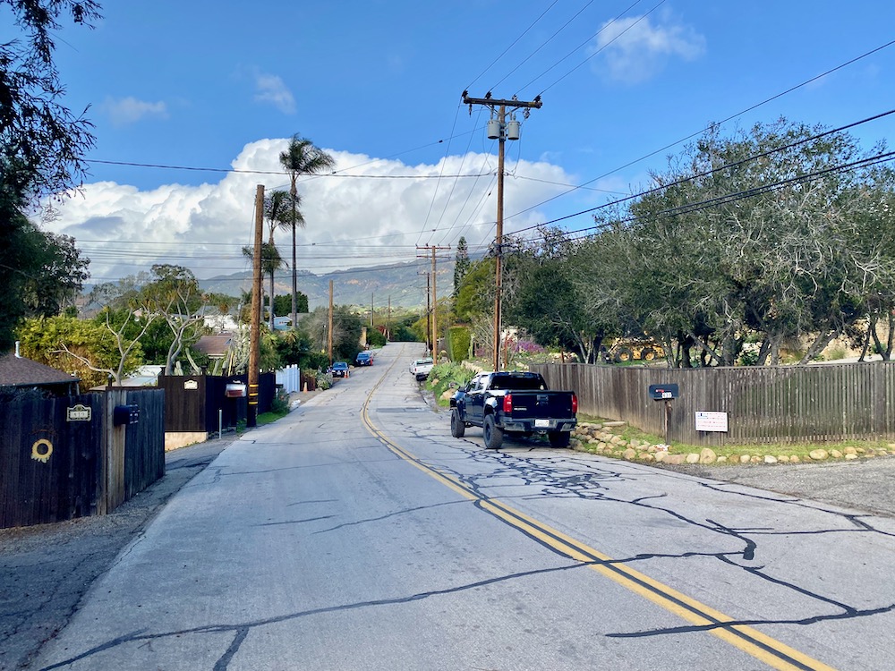
 The housing is all over the place, figuratively and literally—up hillsides and down dips, with many shared driveways. And there are lots of signs warning against trespassing, forbidding parking, and notifying people they’re being filmed. I wonder if there are more cars than parking spaces in the aforementioned mobile home communities.
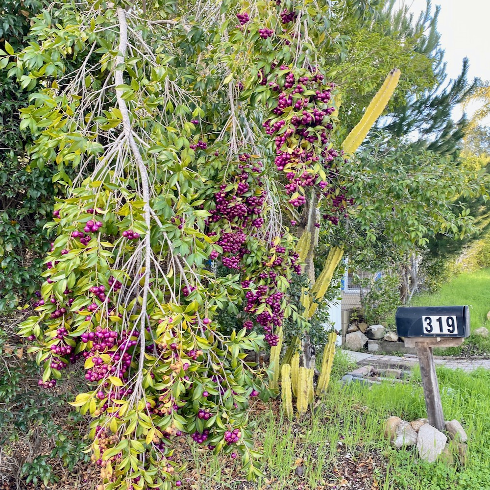
 As you can probably tell, I did this walk not long after the big rain, which turned everything super green. And it was the perfect time to appreciate this plant’s extravagant display of fruit.
 Is this address marker intentionally placed so it’s banging its head against the wall?
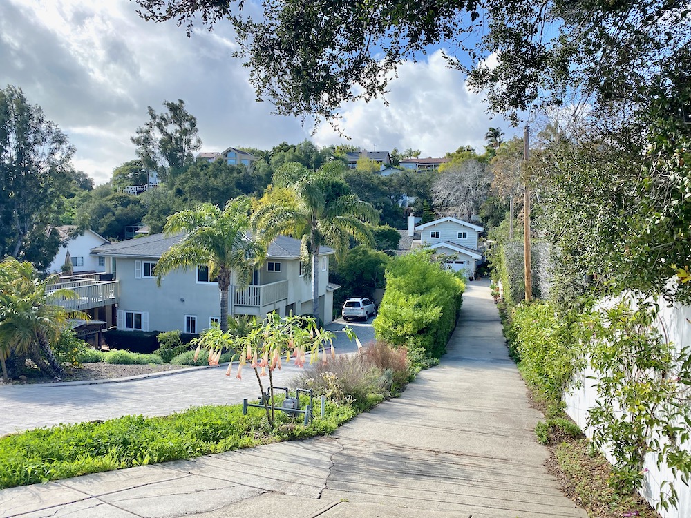
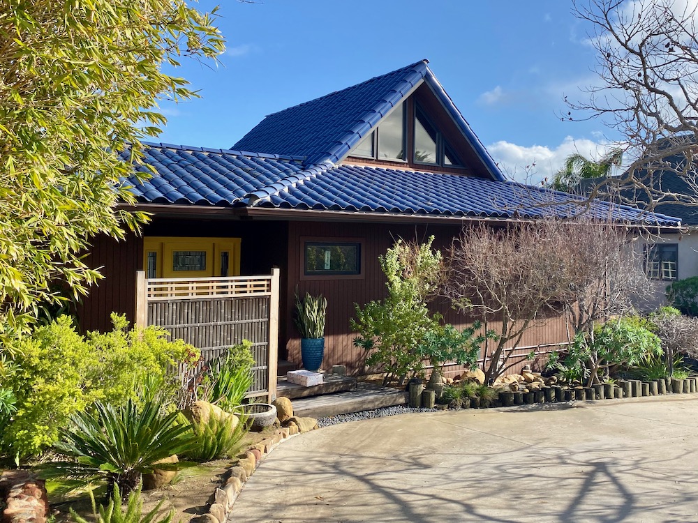
 Google Maps shows a couple of small streets jutting off the southern end of El Sueno, but the only real one is Sherwood Drive. To my eye, the houses there are newer, nicer, and more suburban, with myriad architectural styles. I loved the one with the blue roof.
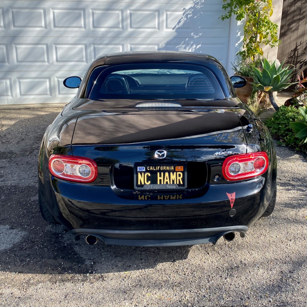
 How I hope this is owned by a 90s hip-hop fan from North Carolina and not someone named Nancy Hammer.
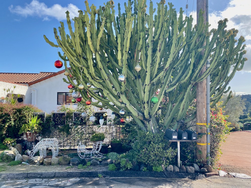
 The big Christmas ornaments looked fantastic on this big cactus.
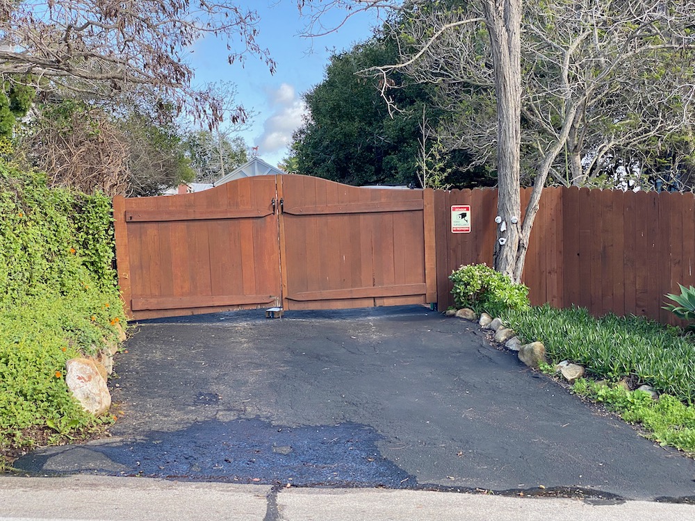
 The whole time I was on Sherwood Drive, which ends in side-by-side driveways, I felt like I was being watched. (And I guess I was.) Perhaps this part of town doesn’t get a lot of midday walkers.
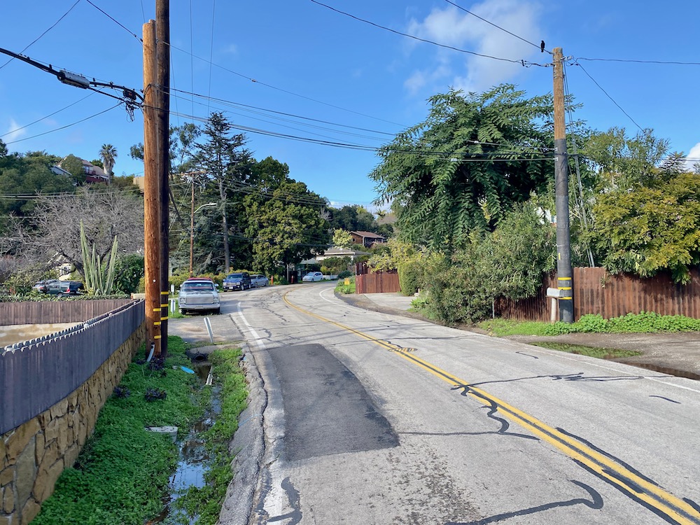
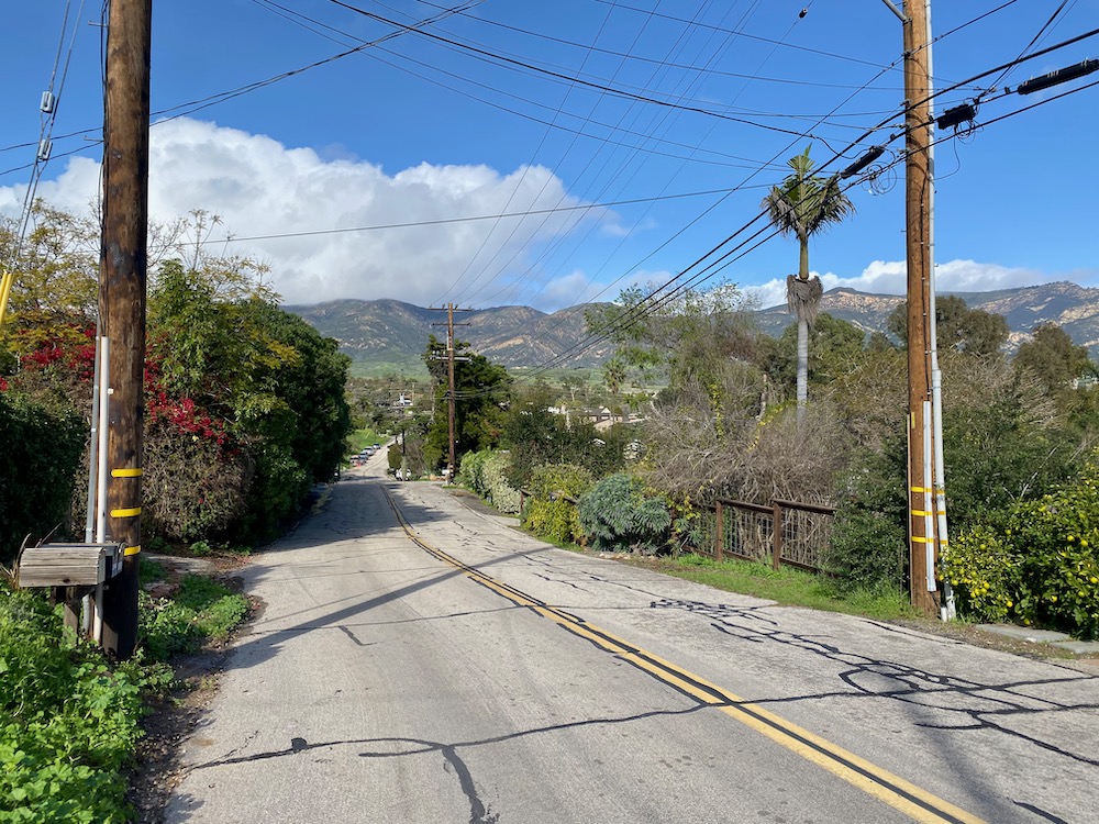
 The farther north you go on El Sueno, the fewer cars there are—same with most dead ends, I suppose—so the lack of a sidewalk wasn’t a problem. It really felt like I was on a country road.
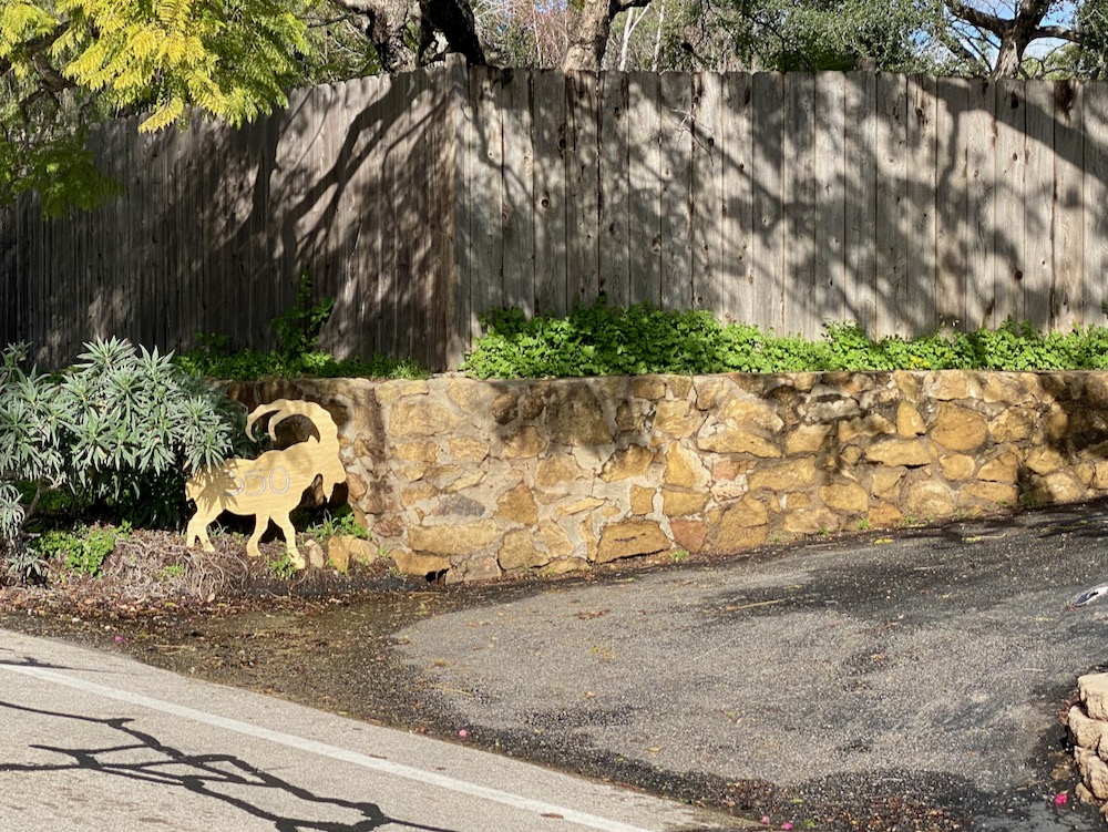
 An impressive array of yard art.
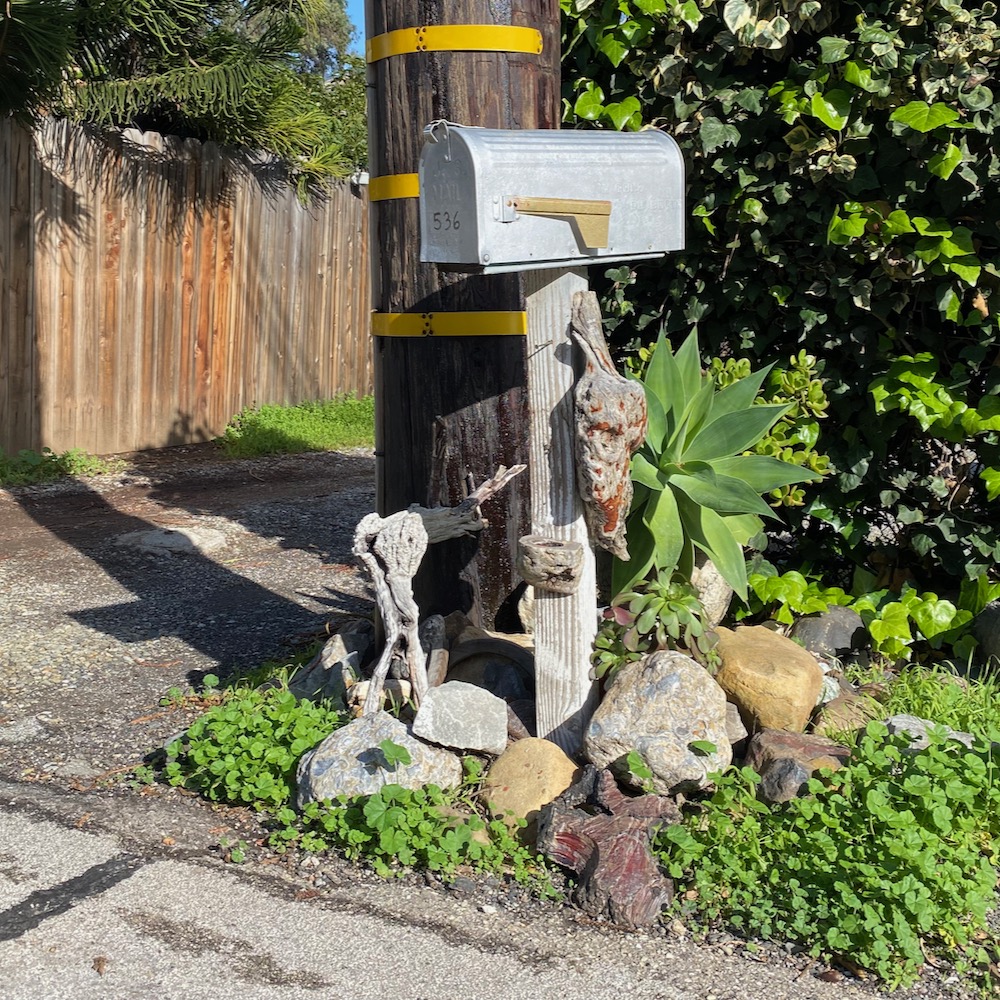
 The (wood?) forms around the post of this mailbox were weirdly biomorphic, and the whole thing reminded me of something you’d see at a contemporary art museum.
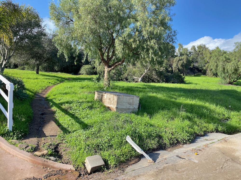
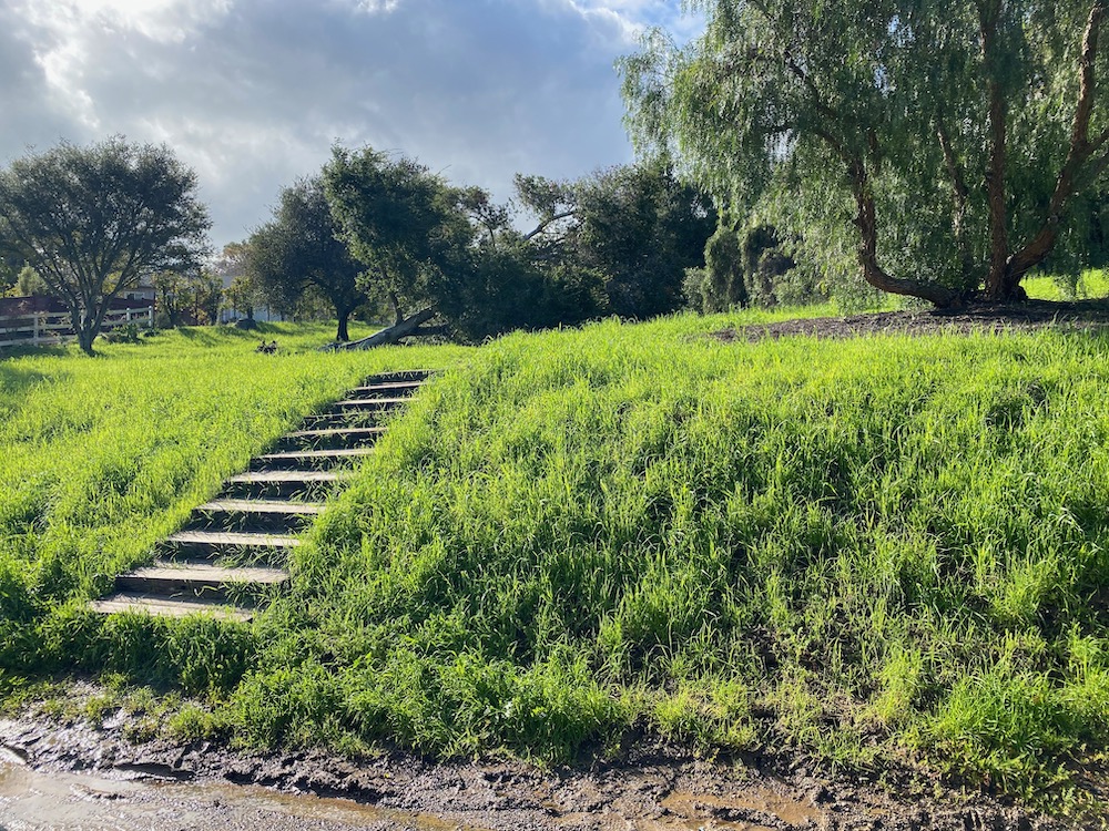
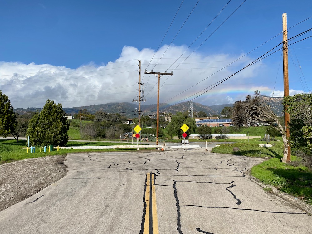
 The northern end of El Sueno borders county offices, with a lot of green space as a buffer. I hope it gets used as a park when it’s not wet and muddy.
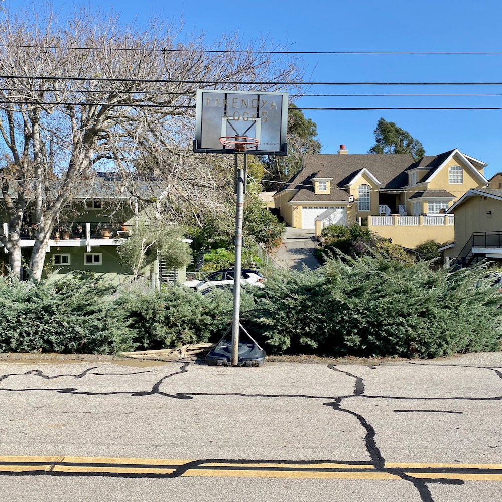
 This bumper sticker made me laugh—it’s a zombie riff on “eat local,” I think. And the basketball backboard has “Takenoya rocks” written on it.
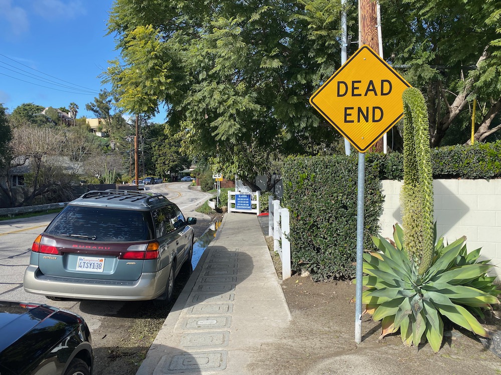
 The end of the road, as promised at the start.
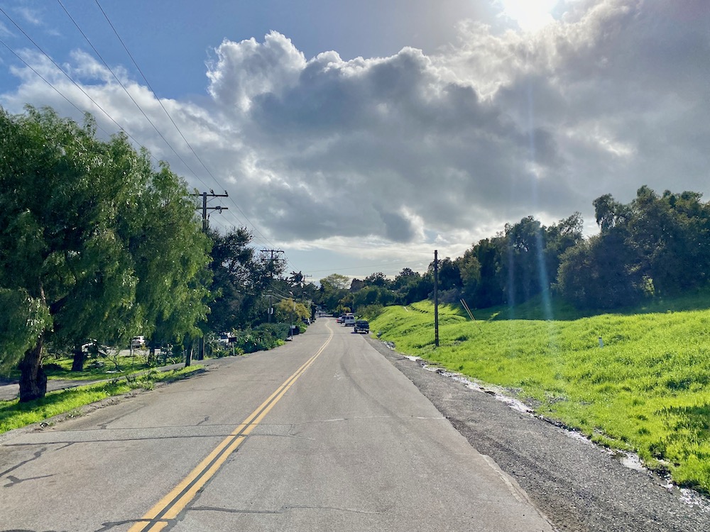
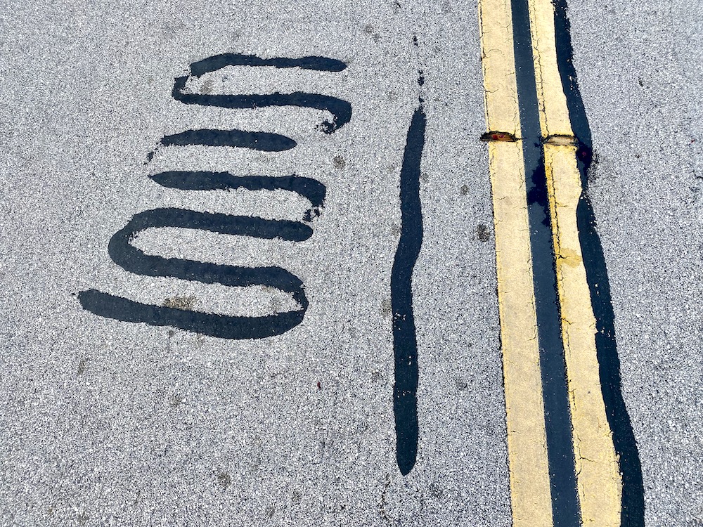
 The clouds made the return even more beautiful. As usually happens when I do an out-and-back walk, I noticed things I had missed before—a couple of skulls hanging out under some mailboxes, and a pavement patch that looked like the scribble you make when testing a pen. And before I knew it—the entire outing took 45 minutes—I had returned to my car, where a man was standing nearby, facing a fence. He, too, was adding to the rustic vibe: he was taking a leak.
 ················
Walk With Me…
Downtown Santa Barbara
• The Presidio: In the Footsteps of Old Santa Barbara
• Brinkerhoff, Bradley, and Beyond
• Mixing Business and Pleasure in East Beach
• It’s Only Milpas Street (But I Like It)
• The Haley Corridor Is Keeping It Real
• The Small Pleasures of Bungalow Haven
• Is There a Better Neighborhood for a Stroll Than West Beach?
• E. Canon Perdido, One of Downtown’s Best Strolling Streets
Oak Park / Samarkand
• The Side Streets and Alleyways of Upper Oak Park
• The Small-Town Charms of Samarkand
Eucalyptus Hill
• On the Golden Slope of Eucalyptus Hill
• Climbing the Back of Eucalyptus Hill
San Roque
• Voyage to the Heart of the San Roque Spider Web
TV Hill / The Mesa
• Walking in Circles in Alta Mesa
• West Mesa Is Still Funky After All These Years
• A Close-Up Look at TV Hill
Hidden Valley / Yankee Farm
• An Aimless Wander Through Hidden Valley
• The Unvarnished Appeal of Yankee Farm
Montecito
• The Heart of Montecito Is in Coast Village
• Quintessential Montecito at Butterfly Beach
• Once Upon a Time in the Hedgerow…
• Where Montecito Gets Down to Business (Coast Village Circle)
• In the Heart of the Golden Quadrangle
• Up, Down, and All Around Montecito’s Pepper Hill
• Montecito’s Prestigious Picacho Lane
• School House Road and Camphor Place
Summerland / Carpinteria
• A Stroll in the Summerland Countryside
• Admiring the Backsides of Beachfront Houses on Padaro Lane
• Whitney Avenue in Summerland
Goleta / Isla Vista
↓↓↓ Where the Streets Have Full Names
• The Past Is Still Present in Old Town Goleta
• Social Distancing Made Easy at UCSB
 ················
Sign up for the Siteline email newsletter and you’ll never miss a post.


Fun for a curious pocket of No-leta… or is this Santa Barbara? I dunno. But the off-ramp always seemed curious, but vital because of the county offices, dump, etc.
I was hopeful you might also explore another curious neighborhood. The homes that seem to be only accessible by the traveling under the 154 on Piro Lane or Primavera Road. It almost feels gated — because of the underpass into the neighborhood — and there’s a good mix of architecture. But I have always wondered if this neighborhood lost a battle with access due to the massive mobile home parks to the west of it? Anyone know its history?
Oops, I was mistaken — it’s not Piro Lane, but rather La Colina Road that provides access into the neighborhood I am talking about! Right behind Sansum’s Pesetas location.
I do know some history of the subdivision that used to be known as “San Marcos Gardens,” just three streets by two (Verano, Rosario, and Consuelo by Primavera and San Martin). Built during 1958-60, it didn’t have either Hwy 154 going through it (extension built in the late 1960s) or the San Vicente mobile home park behind (built in the late 1970s). It also has the Verano Courtyards apartment development at the end of La Colina and Verano. The properties on the western side of Consuelo mark a western boundary of the City of SB.
In the late 1960s, Hwy 154 was extended to reach Hwy 101. Previously, it terminated at Cathedral Oaks/Foothill. As part of that expansion, the homes on the eastern side of Verano were actually moved! Makes sense, as they were not even a decade old. You can find them on Yaple Ave (just west of Turnpike, south of Cathedral Oaks). The last original resident on Verano recently passed away, but for decades the homeowners remaining on Verano would undertake the upkeep of the sidewalk on the “far” side of Verano in honor of their former neighbors (now up to CalTrans as part of Hwy 154 property).
In the late 1970s, when San Vicente MHP was being built on a former open space (which the properties on Consuelo backed onto), St Vincent’s gave up a slice of their property to the homes on Consuelo, effectively moving the boundary of the properties (and the City of SB) slightly west.
Currently, CalTrans is updating (and beautifying) the overpasses at Primavera and La Colina. The area is a part of the Hope School District and has Bishop Diego HS and La Colina JHS nearby.
THIS is amazing! Thank you so much for sharing this knowledge/history!
:-D Very glad you enjoyed it! Definitely worth a quick tour and then over to Yaple to see the “mirror neighborhood.”
The predominant user of the exit is north-bound 101 traffic going to the multitude of county offices and the dump to the west of el sueno. The jail, the dump, the county road yard, elections, VA clinic, public wealth, behavioral health & wellness, air pollution control, ag commissioner, architectural archives, and the dept. of social services are all located at the county complex.
And people who missed the pass exit and have double back
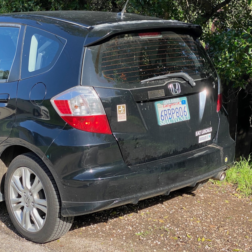
The Mazda internal reference code for the third generation of Mazda Miata is “NC” so I believe the plate is a fun play on that.
You are correct about this plate and the owner making a fun play! Mazda Miata MX-5 models were first sold in 1990 as “NA” models (known for their pop-up headlights), replaced by the second-gen “NB” in 1999 and sold until 2005. The third-gen “NC” from 2006-2014. Current models (including the new RF version) are fourth-gen “ND” variants.
Loved this article! I live in the “Smurfs condos,” and have walked up and down El Sueno often; it is indeed an interesting area! Thanks for venturing out here and sharing your thoughts. :)
Wow, thanks for sharing this. I owned the “A frame” house on Sherwood dr. for 22 years and loved the neighborhood. Your tour brought back some fond memories.
The reason the houses on Sherwood are “newer” is that every house but one was burned down in the Painted Cave Fire on June 27, 1990. We lived in a cottage behind a main house on Sherwood and lost everything but our cats that night. I was only able to save them because a sheriff’s deputy compassionately let me through the blockade at Hi-Time around 5pm. The air was thick with smoke by then, a fire also having started at the dump a short while before the Painted Cave fire roared down the mountain and jumped the 101, and by midnight, almost 500 structures from San Antonio Ranch to Hope Ranch were gone, including most on Sherwood and some on El Sueno. (Also, El Sueno and Calle Real used to be open to through traffic.) As a side note, we lost one of the best restaurants around, The Philadelphia House, on Hollister. Finally, it’s important to remember that this was arson (purposefully started on Painted Cave Road off Hwy 154 on a hot, Santa Ana night) and murder, since a woman was killed in the fire, not to mention the many horses and wildlife in the way of its path that night.