
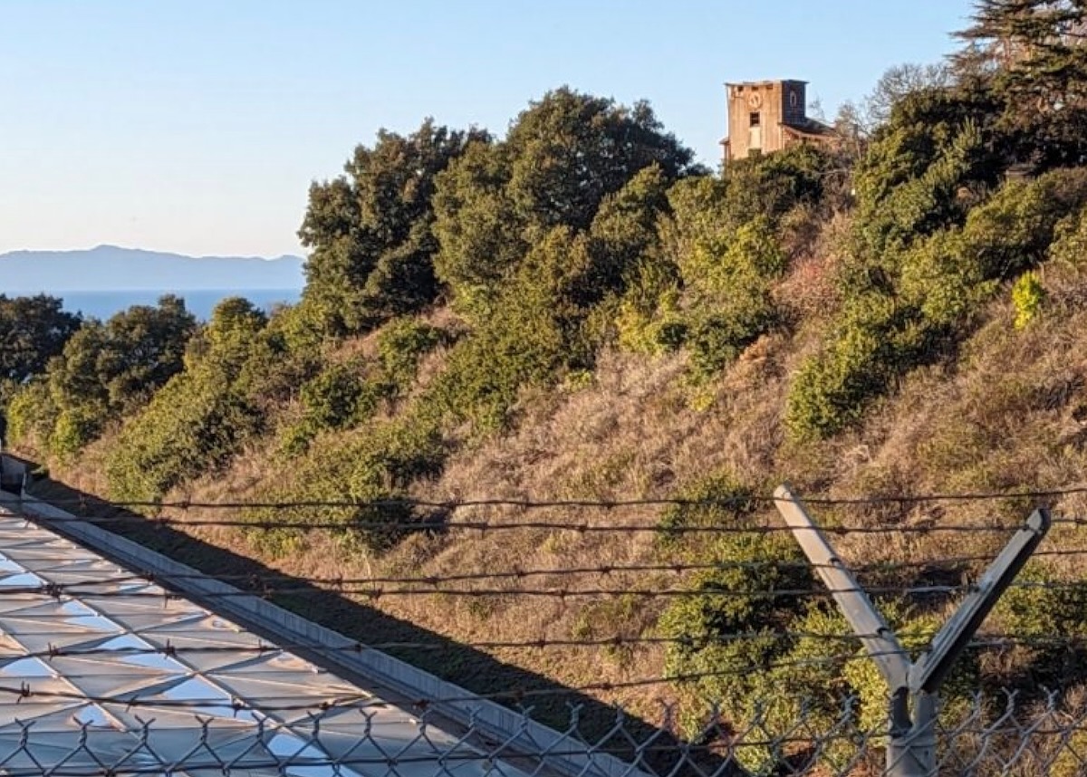
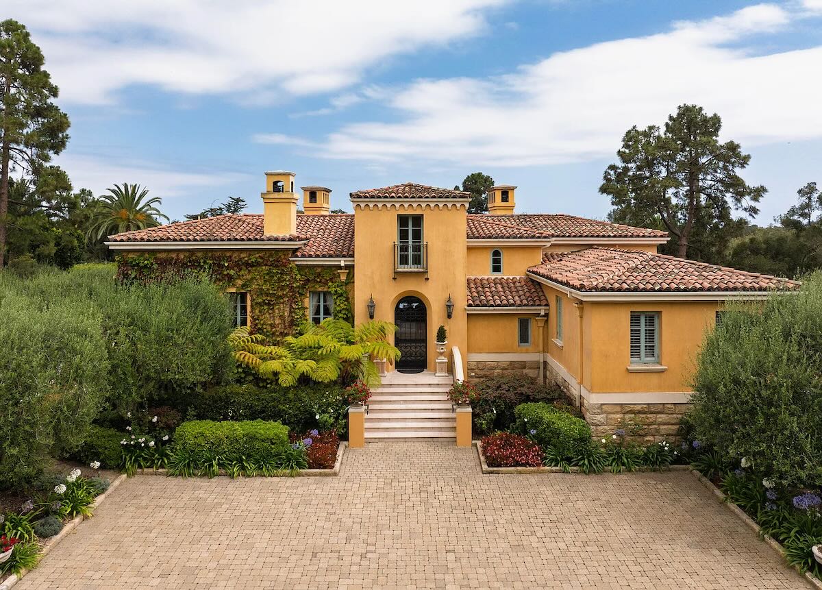
I was on a trail run with some friends behind Summerland. We were on Hunt Drive and when you look across where the Ortega Reservoir is, there’s a house up on the hill that seems very old. From a distance, it looks like it may have a clock tower. The address shows up online as 484 Ortega Ridge Road but it’s really on Hunt Drive. Would you have any information about this building? Maybe it was a school or a commercial building back in the day? —B.
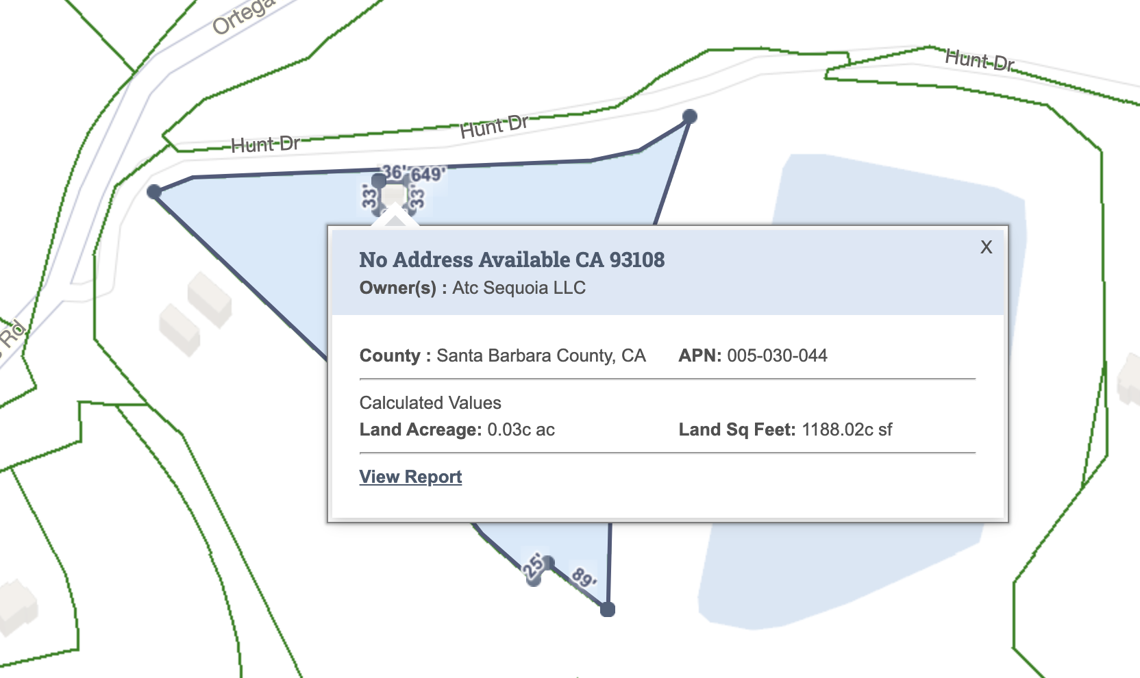
I asked the Montecito Association and the Santa Barbara Historical Museum, but they didn’t know anything about the building. So I tried some expert real estate agents, and one pointed out that there’s a second parcel (with no address) embedded Lesotho-style within the triangular 484 Ortega Ridge lot. Moreover, the building is square-ish, like it could be the tower in B.’s photo.
 I went for a look. Not far from Ortega Ridge Road, there is indeed a square-ish building—but it’s not the one in B.’s photo.
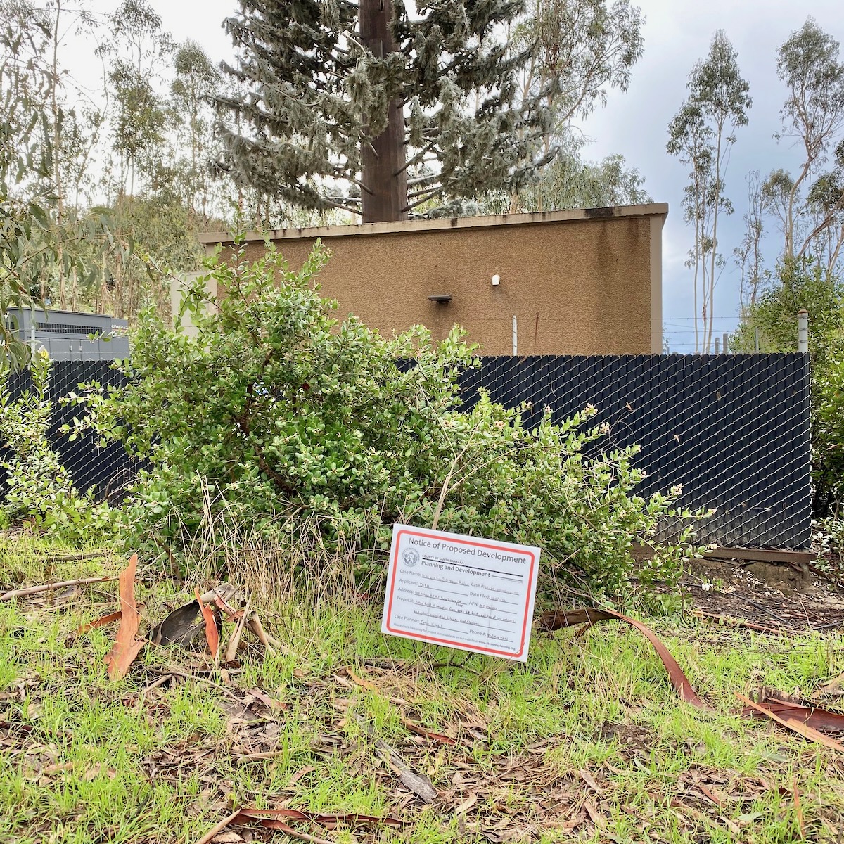
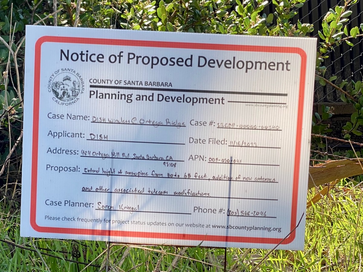
 It is, however, worth a digression. The archives of the County’s Planning and Development archives included the 2013 conditional use permit granted to Verizon Wireless for “an unstaffed telecommunications facility [with] twelve panel antennas with four antennas per sector at 0, 120, and 240 degree azimuths (from north). The antennas would be mounted on a new 60-foot tall antenna support structure designed to resemble a pine tree, and would be split into two arrays of six antennas mounted at a height of 45 feet and 52 feet, respectively. The antennas would operate in the cellular, PCS and LTE bandwidths. The proposed facility would cover portions of Montecito and portions of Summerland. All support equipment for the facility would be located in a new approximately 190 square foot prefabricated equipment shelter within the fenced lease area.”
This was exciting for several reasons. First, the word “azimuth” has finally appeared on my website. (Wikipedia defines the term as “the angular measurement in a spherical coordinate system which represents the horizontal angle from a cardinal direction, most commonly north.”) Second, I learned the word “monopine” (“a monopole disguised as a pine tree”). Third, this monopine is growing! Dish Wireless has applied to extend the height from 60 feet to 65 feet, with the “addition of new antennas and other associated telecom modifications.”

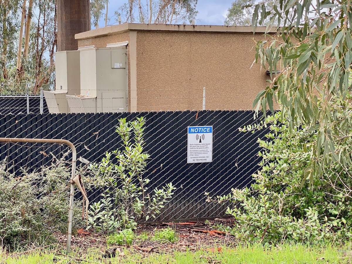
 That’s as close as I got to the monopine, because the warning sign says that “radio frequency fields beyond this point may exceed FCC limits for the general public.”
Back to 484 Ortega Ridge proper…. I pulled my head out of a certain crevice and looked on Google Earth, which I often forget exists. The tower in B.’s photo is definitely among the structures in the compound.
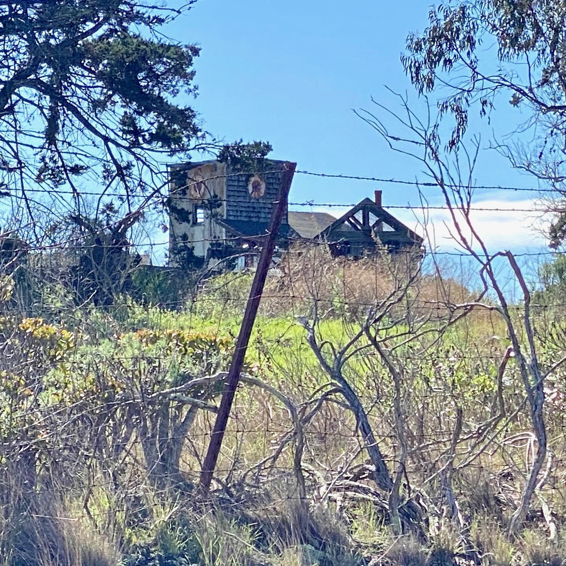
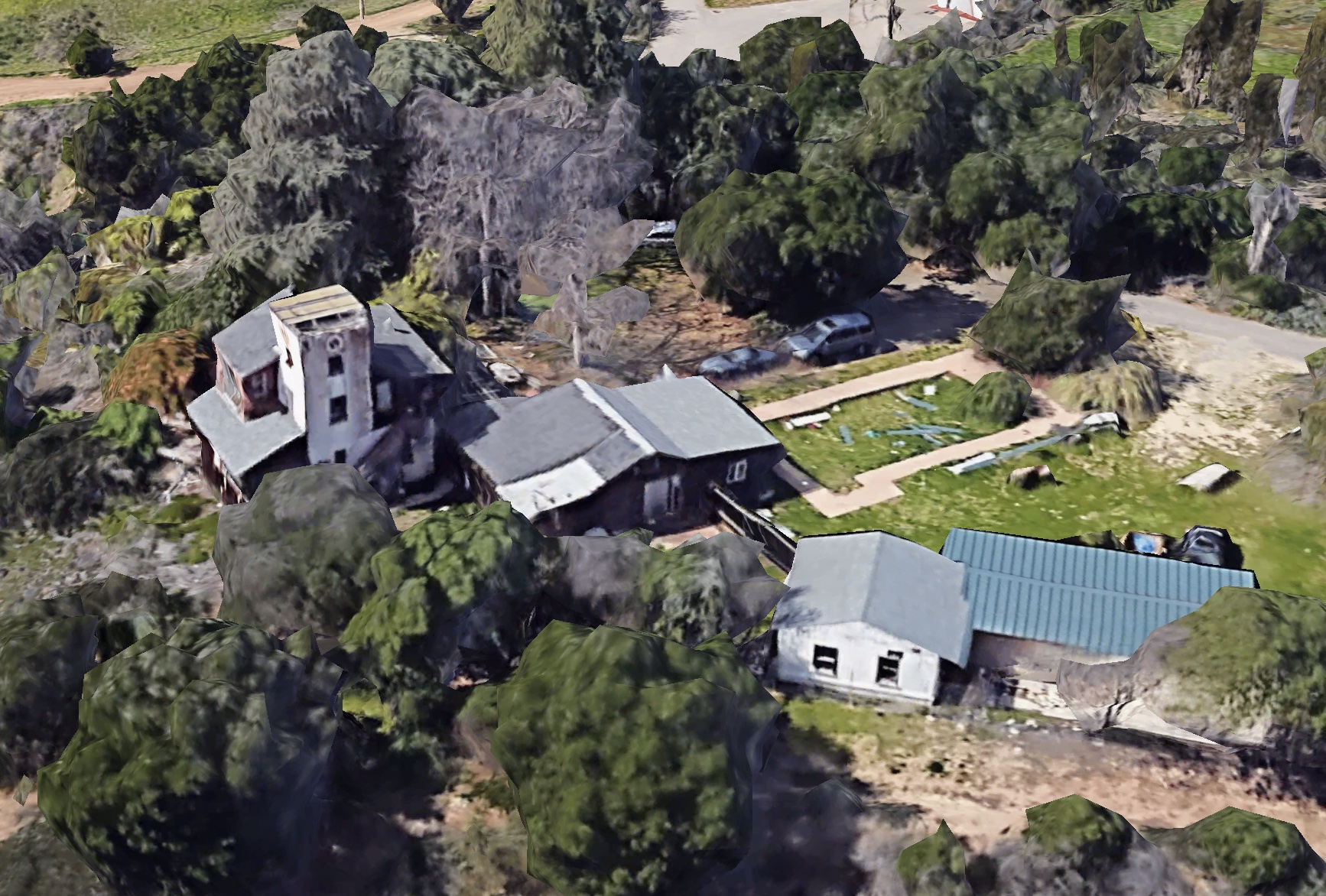 And I returned to Hunt Drive for another look, this time making an effort to zoom in more clearly. It’s impossible to say what the building started out as, although I’d venture that it was never a clock tower, and the structure appears to be in disrepair.
 I looked up the owners’ names, and I wrote them a letter. I didn’t hear back, and I can’t blame them—I’m not sure I would’ve acknowledged it, had I been in their position. And anyway, sometimes the journey really is more interesting than the destination.
Got a question you’d like investigated? Email [email protected] or text 917-209-6473.
················
Previous Burning Questions:
••• What’s up with these sculptures on a hillside in Summerland?
••• Is there a master plan for the new walking paths in Montecito?
••• Why are the Thousand Steps still wet?
••• What’s happening with Sola Street?
••• Why are trees being cut down above the San Ysidro Ranch?
↓↓↓ Why is this lot on Milpas Street still vacant?
••• Where else do cruise ships that visit here go?
••• What’s happening with the Pepper Tree Inn?
••• What is this large memorial in Ennisbrook?
••• What’s the large building under construction next to Highway 101?
••• Who bought the former St. Mary’s seminary—and why?
••• What will happen to the SBPD building when the new building is completed?
••• How does the city decide to mark bike lanes?
••• What’s the story with this house on W. Cota Street?
••• What are those little houses on Santa Barbara Street?
••• Which Highway 101 exits are getting renamed?
••• Is the Music Academy of the West adding pedestrian gates?
••• Why does the Coast Village Road median look so bad?
••• What’s the point of this light pole near the freeway?
••• Why are the city’s parking lots scanning license plates?
••• What’s inside Paseo Nuevo’s State Street tower?
••• What’s the point of these markings on Laguna Street?
••• Why is there a giant red shoe off Highway 101?
••• Are we no longer allowed on the SBHS baseball field?
••• What does “SBTP” on this post mean?
••• What’s up with the “no e-bike” signs on local trails?
••• Why is Franceschi House in a holding pattern?
••• Why is there a train station inside this State Street storefront?
••• What’s happening with this derelict house in Summerland?
••• Why is there wood on some power lines?
••• Can you explain how sundowner winds work?
••• Why is there a pressure cooker attached to this utility pole?
••• What’s this concrete ramp thing on East Beach?
••• Why does “USA” get written on the street?
••• What are those poles in the ocean near the Ritz-Carlton Bacara?
••• Are people really allowed to set fires in the middle of Montecito?
••• What’s the story with the half-finished lot next to the Montecito Country Mart?
 ················
Sign up for the Siteline email newsletter and you’ll never miss a post.


A monopine! I feel a little bit smarter after finding out what this is called. Thank you Erik for the fun read this morning.
I was told it was painted as a clock tower for a movie many years ago and the owners liked it, so they kept the painted clock.
The house and property were a bit of a mess when I was in it some dozen years ago. This was around the same time the cell tower went up in that small parcel. No idea what’s happening with it now. It’s a spectacular piece of property. The views are incredible and now that the reservoir is covered, the crows that were once a murderous annoyance are gone and peace and quiet is now the norm.
FYI – I do believe the road and area is private property, so tread lightly. There is a trail up to the ridge via the MTF route that runs from the west side of ORR and the Valley Club and then up the backside of the hill near 192. There is also a recently installed fire camera right there that you can view on the web. If one is interested in seeing the view in real time.