

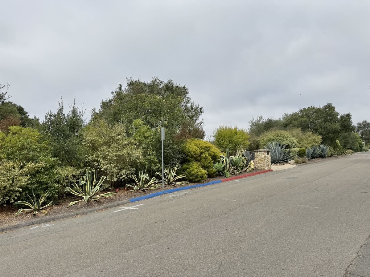
On my way to the El Cielito trailhead, I noticed blue-curb parking outside a house on Cielito Road. Can any homeowner request it? —V.
According to the Accessibility Resources section of the City of Santa Barbara’s website, accessible parking in residential areas was “established to accommodate the parking needs of a disabled resident when an accessible off-street space is not available or feasible.” The resident can be an owner or a renter. The application lays out the criteria:
• Applicant (or guardian) must be in possession of a valid license plate or placard for “disabled persons” or “disabled veterans” issued by the California Department of Motor Vehicles.
• Applicant must provide a photo or copy of their vehicle registration for valid “disabled persons or disabled veterans” license plate or of valid placard. To submit with your online application, the file must be in either JPEG or PDF format.
• The applicant has a vehicle registered in his/her name, or in the name of their primary, live in caregiver.
• If residence has off-street parking, a detailed explanation must be provided for why that space is not sufficient to meet, or cannot be reasonably modified to meet accessibility needs.
Once the curb is painted blue, anyone with a disabled-driver placard or plates can park there. And “accessible Parking Zones are monitored and reviewed annually” by the Downtown Parking department, which oversees the program.
As for the accessible parking spots in commercial areas, downtown services manager Sarah Clark offered this explanation:
We spread blue zones throughout our commercial districts and try to make sure we have disabled parking available near essential services, such as the post office, government buildings, medical clinics, etc. (if off-street parking is in short supply). We do accept blue zone requests from businesses, or any member of the community, although these requests are pretty uncommon outside of residential areas. For each request, we would evaluate both off- and on-street parking availability, as well as the layout of the curb space in the area before making a determination about where a space can be added.
Is there a question you’d like investigated? Email [email protected] or text 917-209-6473.
················
Previous Burning Questions:
••• Has Santa Barbara County experienced a property tax windfall since Covid?
••• What’s the story with the old building near the train tracks in Montecito?
••• Hermosillo Road’s history, Hank Pitcher’s mosaic benches, missing Chase Palm Park plaque, and more.
••• What are these signs at the San Ysidro roundabout?
••• Can anything be done about biting midges?
••• How come the Gaviota rest areas are closed so often?
••• Why is the Cliff Drive overlook closed?
••• Who installed this security camera in Montecito?
••• Why are the railroad tracks being expanded along Padaro Lane?
••• Will you explain the plan to adapt the waterfront for climate change?
••• Why did the Rosewood Miramar Beach install gates?
••• How long will this big pipe be at East Beach?
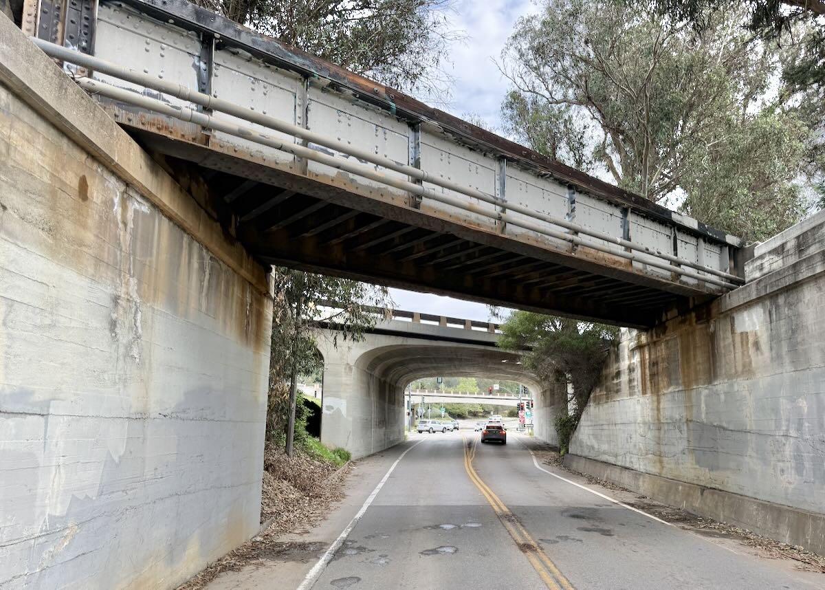
↓↓↓ Is Cabrillo Boulevard going to be widened under Highway 101?
••• Was there a Fisherman Inn in downtown Santa Barbara?
••• What are those old buildings at the corner of Castillo and Montecito streets?
••• What’s this scaffold structure on Las Positas Road?
••• Why does street striping take so long to happen?
••• Why do rocket launches look the way they do?
••• How is the San Ysidro Debris Basin designed to work?
••• What’s this building on Helena Avenue?
••• What are those old pilings in Arroyo Burro Creek?
••• What’s this building under construction in Toro Canyon?
••• What’s the story behind the seal of the City of Santa Barbara?
••• Butterfly Beach steps, green power lines, SBAG license plates, and more
••• What’s this pole with a flashing blue light?
••• What are these sculptures on the Riviera?
••• What’s the origin story of this fence on Hot Springs Road?
••• Why is part of this West Beach mosaic covered in concrete?
••• What was the Weeping Willow Inn?
••• What does the “S” on certain chimneys stand for?
••• What’s the status of the decommissioning of Rincon Island?
••• What happened to the gas flame on Highway 101?
••• What do we know about the proposed apartment complex at 1 Hot Springs Road?
••• What’s the history of this tower on Ortega Ridge?
••• What’s up with these sculptures on a hillside in Summerland?
••• Is there a master plan for the new walking paths in Montecito?
••• Why are the Thousand Steps still wet?
••• What’s happening with Sola Street?
••• Why is this lot on Milpas Street still vacant?
••• Where else do cruise ships that visit here go?
••• What is this large memorial in Ennisbrook?
••• Who bought the former St. Mary’s seminary—and why?
••• What will happen to the SBPD building when the new building is completed?
••• What’s the story with this house on W. Cota Street?
••• What are those little houses on Santa Barbara Street?
••• What’s the point of this light pole near the freeway?
••• What’s inside Paseo Nuevo’s State Street tower?
••• What’s the point of these markings on Laguna Street?
••• Why is there a giant red shoe off Highway 101?
••• What’s up with the “no e-bike” signs on local trails?
••• Why is Franceschi House in a holding pattern?
••• What’s happening with this derelict house in Summerland?
••• Can you explain how sundowner winds work?
••• Why is there a pressure cooker attached to this utility pole?
••• What’s this concrete ramp thing on East Beach?
••• Why does “USA” get written on the street?
••• What are those poles in the ocean near the Ritz-Carlton Bacara?
••• Are people really allowed to set fires in the middle of Montecito?
••• What’s the story with the half-finished lot next to the Montecito Country Mart?
 ················
Sign up for the Siteline email newsletter and you’ll never miss a post.









The blue curb was added at El Cielito after parks and rec added an accessible trail to the upper Parma loop. It was not at the request of the homeowner. I’d be curious to know if folks find it useful given the grade of the street right there