
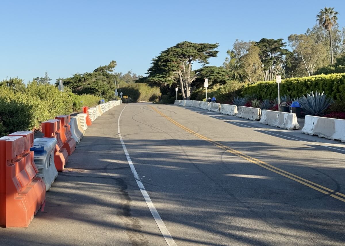
“I see the new walking paths are making headway down Sycamore Canyon Road. Do you know if there’s an overall master plan for these walkways?” —F.
The Bucket Brigade, which is constructing the paths, has a trail map on its website. I cropped it here to make it slightly easier to read.
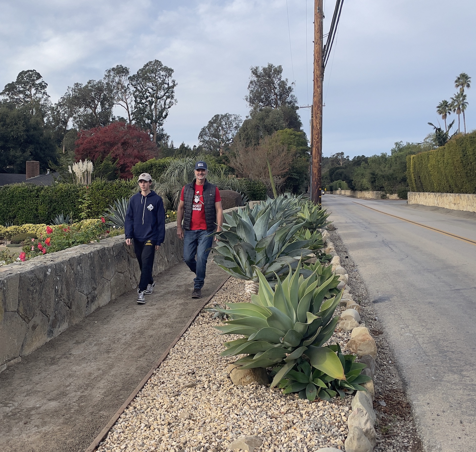
 Unsure of the difference between formal and informal trails, I began an email exchange with the Bucket Brigade. Formal trails are “decomposed granite paths on road shoulders that are protected from asphalt curbs (berms).”
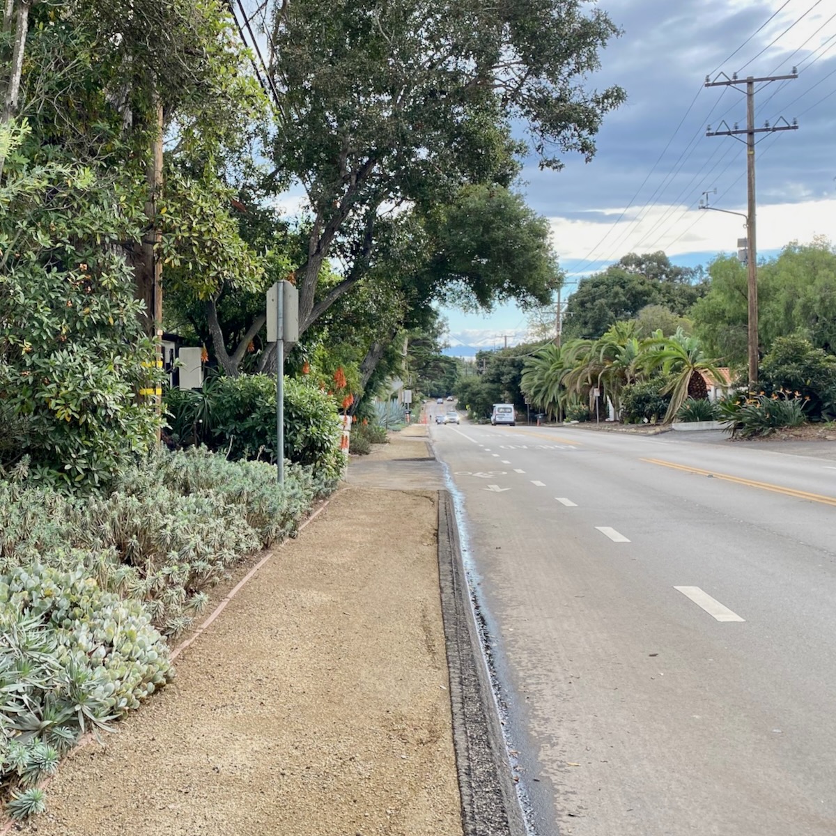 Informal trails, meanwhile, are made of “local brown shale along roadways where there is no curb to protect the path from road runoff and parking damage.”
 The map lists two roads—Sycamore Canyon and Camino Viejo—as “proposed,” even though trails have been under construction there for a while. As for the others, “all of the trails on the map in the County are now in the final permitting phase and are conceptually a go for construction.” The exceptions to that are the two parts where the trails cross into the City of Santa Barbara—on Camino Viejo west of Alcala Lane and on Barker Pass below Calle Bello. “The City of Santa Barbara does not want road shoulder trails and has made it clear that they prefer that people walk in the street.” So those are on indefinite hold.
I asked whether the organization expects to start work on any of the remaining “proposed” trails—Eucalyptus Hill, Barker Pass, Middle Road, Hot Springs, San Leandro, and S. Jameson—in the first quarter of 2024, and whether it has funding for any or all of them.
Generally speaking, Q1 is about trail planning, protection, and repair. Winter rains do a lot of damage to trails and make construction difficult and sometimes impossible. Last winter caused extensive damage along our Olive Mill and Hot Springs Neighborhood Trails. We are hoping to do better this winter with sandbags and drainage controls, but we shall see. Like Hamlet said, “the readiness is all,” and we stand ready to maintain our trail network during the winter months. We are in the final stages of planning for Lower Sycamore Canyon, Middle Road, and Hot Springs between Middle Road and Olive Mill, and will return to full-time trail construction as soon as things dry out this spring.
In terms of funding, we have raised $1.5 million of the $2.5 million Walk Montecito goal. We have over $800,000 on hand for the project and we intend to put that money to work in 2024.
Moving forward, we are building on the grassroots neighborhood organizing approach demonstrated in the Camino Viejo/Sycamore Canon area led by Jim Bain, Laura Wyatt, and the Cold Spring Safe-Routes-to-School Committee. When neighbors get involved and rally their communities for safety and resilience improvement, good things happen, as we have seen with the Camino Viejo Neighborhood Trail, Barker Pass Neighborhood Trail and Sycamore Canyon Neighborhood Trail. We are actively raising funds now and currently have an organized team of parents and pedestrians advocating for the San Leandro neighborhood led by Melissa White and Jasper Eiler.
Our longterm plan for trails and all other Community Uplift Projects is simple: organize neighborhoods, raise funds, and improve safety and build community connection, resilience, and access. This, ultimately, is how you build grassroots community resilience under blue sky conditions. Everyone is interested in resilience when a disaster strikes. Few people are interested enough in resilience to take action when things are going well. This is the great challenge of the old “preparedness movement” and the current “resilience movement.” The key to building real resilience capacity at the community level comes from organizing the people who are interested in safety and resilience when things are going well, and to engage them in genuine community resilience-building action.
Actions speak louder than words and, when a neighborhood steps up to make real safety improvements on its own initiative, leaders emerge, supporters engage, and funders step up to help. Successful “Community Uplift Projects” like Walk Montecito engage all three of these key parts of a community and empower them to make real change right where they live and work. The process of community-led, self-transformation, builds a network of neighbors who are willing to step up to improve their community based on shared values and a common vision. This particular kind of neighborhood network is exactly the thing a community needs during a crisis: e.g. The Bucket Brigade.
You can donate here.
Got a question you’d like investigated? Email [email protected] or text 917-209-6473.
················
Previous Burning Questions:
↓↓↓ Why are the Thousand Steps still wet?
••• What’s happening with Sola Street?
••• Why are trees being cut down above the San Ysidro Ranch?
••• Why is this lot on Milpas Street still vacant?
••• Where else do cruise ships that visit here go?
••• What’s happening with the Pepper Tree Inn?
••• What is this large memorial in Ennisbrook?
••• What’s the large building under construction next to Highway 101?
••• Who bought the former St. Mary’s seminary—and why?
••• What will happen to the SBPD building when the new building is completed?
••• How does the city decide to mark bike lanes?
••• What’s the story with this house on W. Cota Street?
••• What are those little houses on Santa Barbara Street?
••• Which Highway 101 exits are getting renamed?
••• Is the Music Academy of the West adding pedestrian gates?
••• Why does the Coast Village Road median look so bad?
••• What’s the point of this light pole near the freeway?
••• Why are the city’s parking lots scanning license plates?
••• What’s inside Paseo Nuevo’s State Street tower?
••• What’s the point of these markings on Laguna Street?
••• Why is there a giant red shoe off Highway 101?
••• Are we no longer allowed on the SBHS baseball field?
••• What does “SBTP” on this post mean?
••• What’s up with the “no e-bike” signs on local trails?
••• Why is Franceschi House in a holding pattern?
••• Why is there a train station inside this State Street storefront?
••• What’s happening with this derelict house in Summerland?
••• Why is there wood on some power lines?
••• Can you explain how sundowner winds work?
••• Why is there a pressure cooker attached to this utility pole?
••• What’s this concrete ramp thing on East Beach?
••• Why does “USA” get written on the street?
••• What are those poles in the ocean near the Ritz-Carlton Bacara?
••• Are people really allowed to set fires in the middle of Montecito?
••• What’s the story with the half-finished lot next to the Montecito Country Mart?
 ················
Sign up for the Siteline email newsletter and you’ll never miss a post.


Are we really going to let that level of pontification slide without a little bit of signature Erik Torkells snark?
Not sure who said what, but the City of Santa Barbara very much creates walking paths all over the city. If someone said something frmo the City, which I cannot tell, who said what, they probably meant they don’t want this type of walking path. It only takes two additional minutes of reading to understand these DG paths get washed away every winter and require money and upkeep every few months.
In Montecito’s master plan, sidewalks are prohibited. It matters not what Santa Barbara does. We are not in the city. The Bucket Brigade is sensitively installing “paths”. They are decomposed granite, and are very safe. So children can safely walk to school. Al the parents, and the head of School have supported this effort! . Happy New Year everyone!
Barker Pass from where this walkway stops and the next city sidewalk on APS picks up could really use something. It’s a speedway with blind curves. But the area that really needs prioritization is the sidewalk approaching the roundabout, downhill from eucalyptus hill. In particular, there is a tree root uplift right on the curve that twice now I’ve passed a mom trying to negotiate a stroller over and nearly tipping it into the street. Cleveland school is just above this and the bus stop is just below. It really needs to be repaired!
The trails have been fantastic and I have seen a big increase in the number of neighbors using them. I feel so much safer walking the dog around the neighborhood. They have held up well in these rains and I hope people can see the benefit and appreciate the hard work to get them installed.