

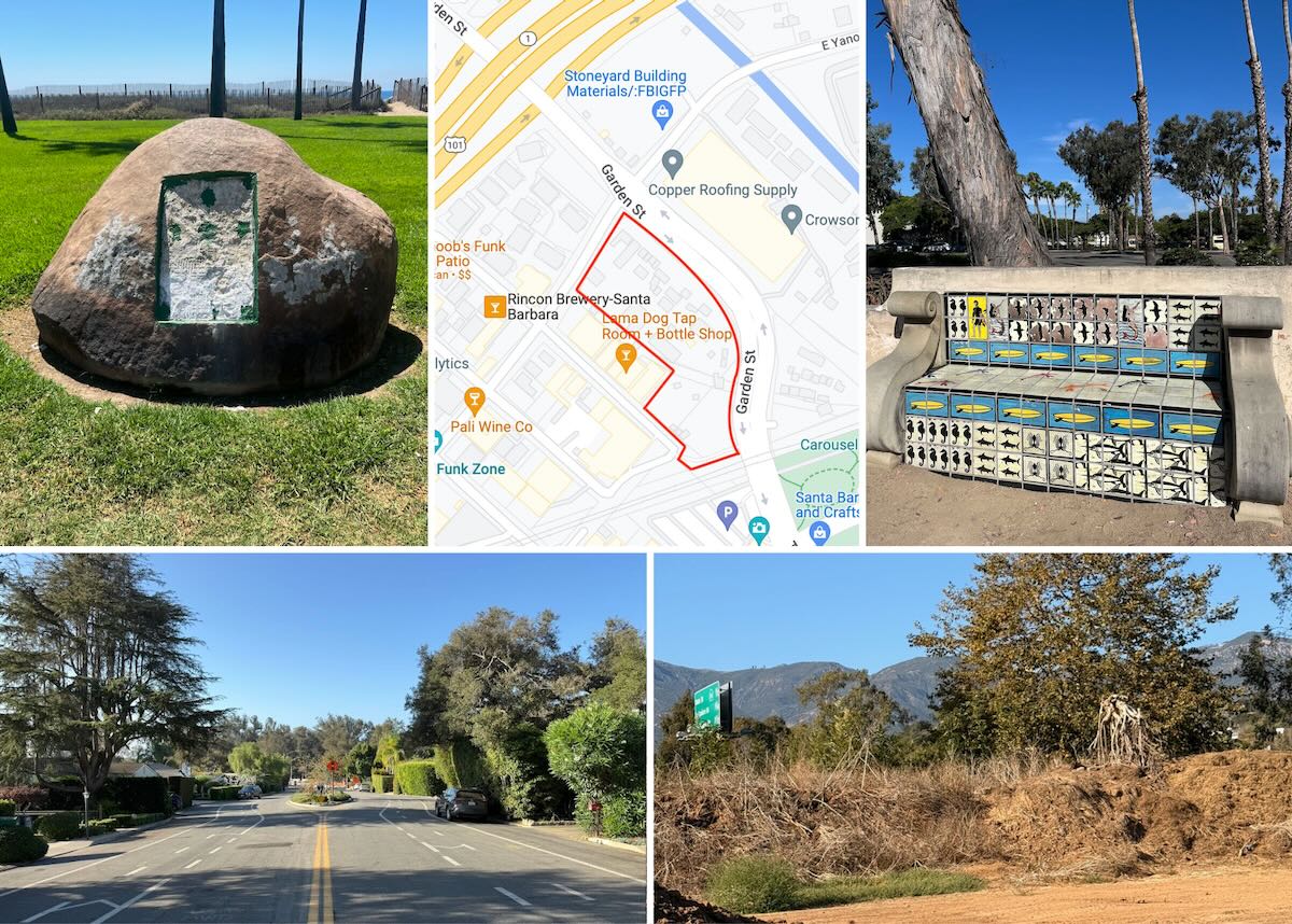
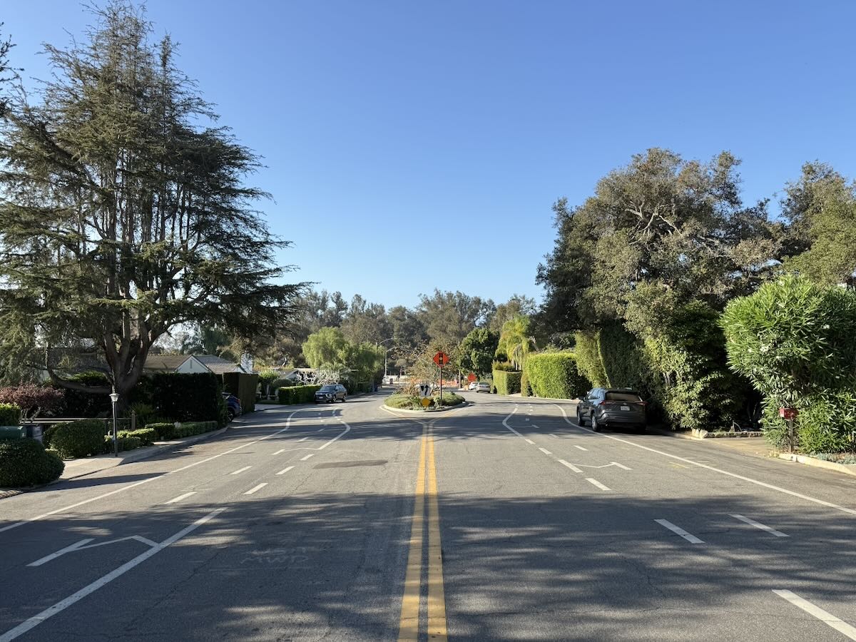
I’m a Montecito native and I’ve never known why Hermosillo Road is so wide. Have you uncovered this? I know there’s a median now, but it was just a super wide road forever. —C.
Santa Barbara Historical Museum archivist Chris Ervin had the answer (along with relevant newspaper clippings):
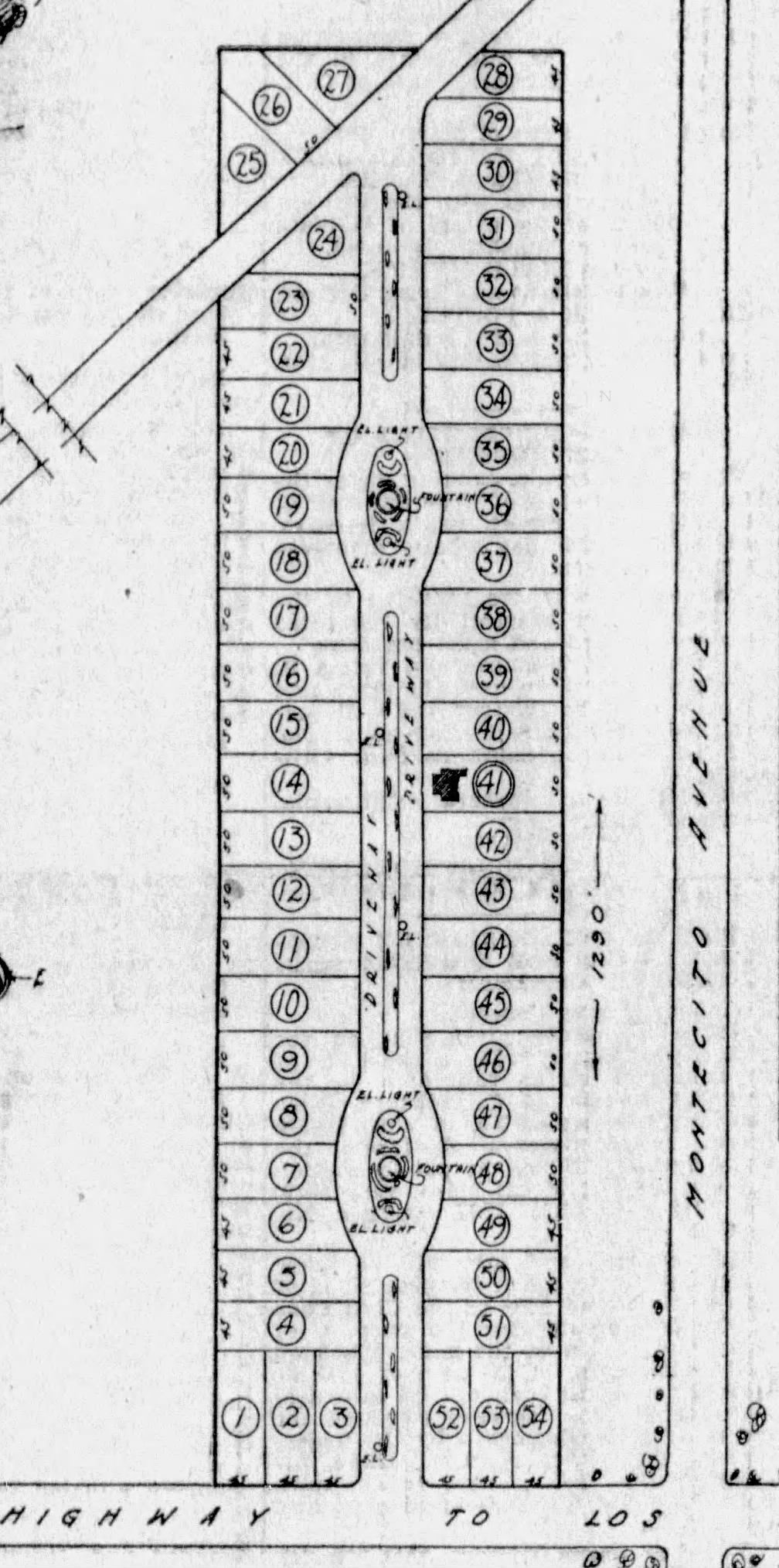
The Montecito subdivision of Hermosillo Court, later Hermosillo Park, was conceived in 1923 by two Santa Maria developers, Gardner and Turner, on a former Gould property running south-to-north and connecting Coast Highway with Hot Springs Road.
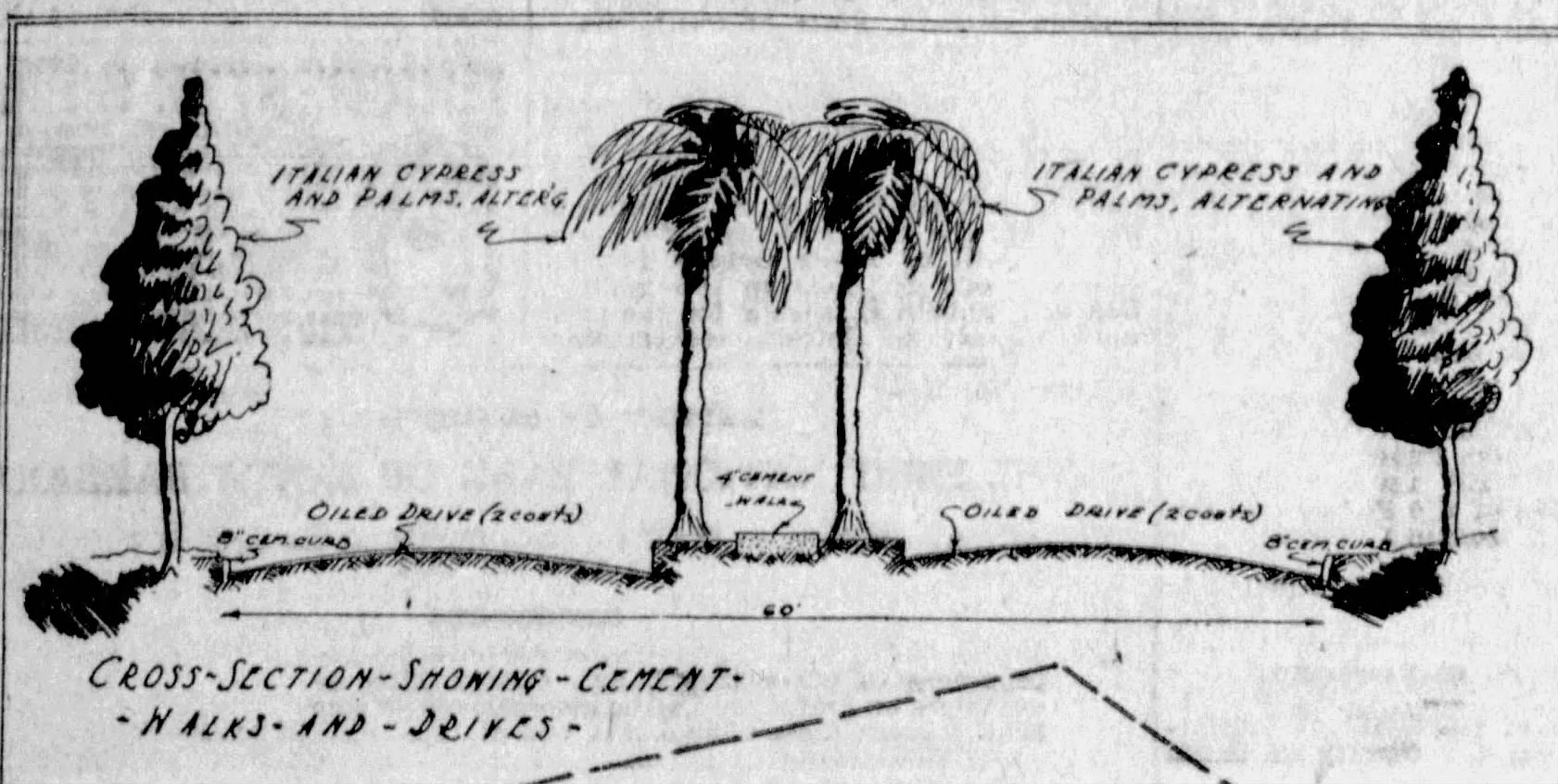
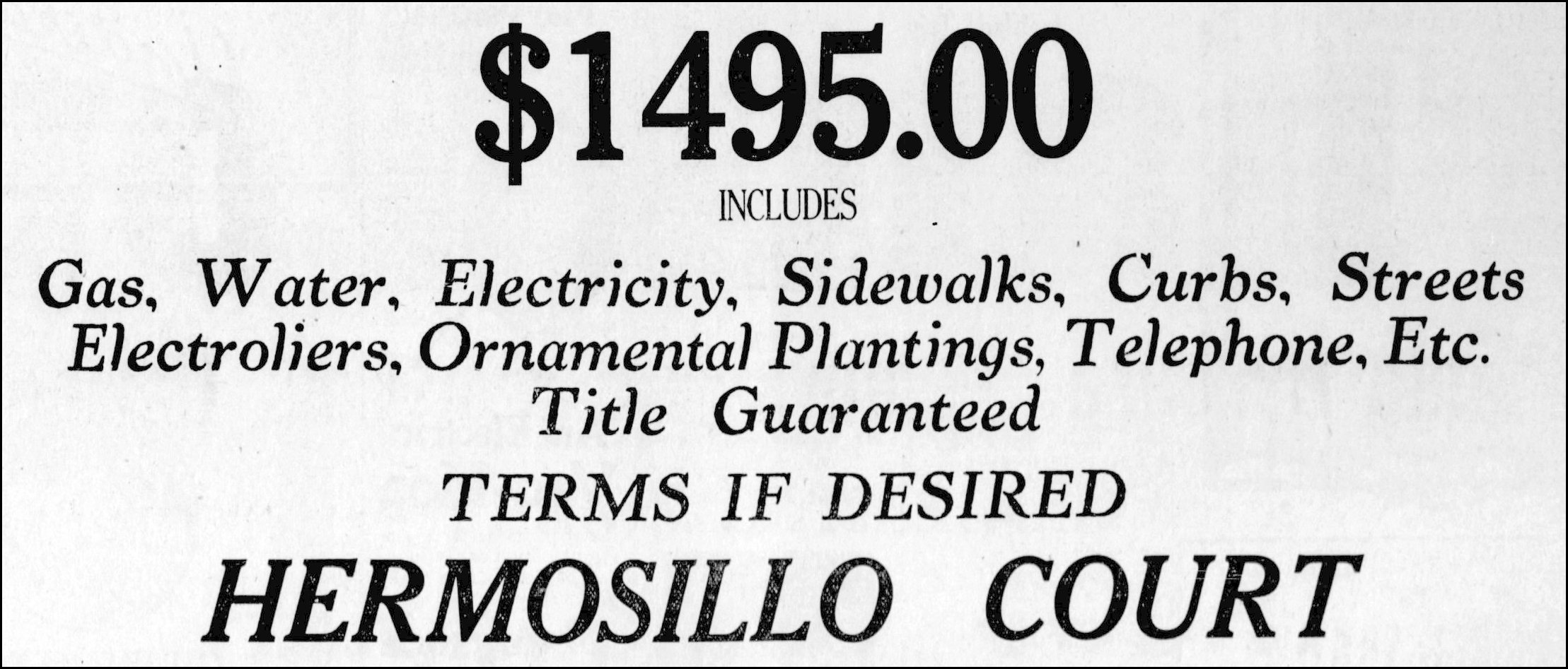
The fifty-four lots were arrayed along a planned 60-foot-wide boulevard containing medians, ornamental lighting (with underground wiring, and two fountains. The developers promised “all cement sidewalks, curbs, and parkings with Palm and Italian Cypress trees.” The roadways on either side of the medians would be “graded and rolled to arch completely from curb to curb with two coats of oil and rolled.”
The 50’ x 135’ lots were offered for $1,495 each in April 1923 (terms available). As a come-on, the developers built/would build a Spanish Colonial style bungalow on Lot 41 and sell both the home and lot for the same $1,495 to the lucky buyer. By mid-May all but six lots were sold. Paving of Hermosillo Road was completed in January 1926 by the County as “…the building up of a new tract in that vicinity necessitated construction of the road.”
 ················
Any idea what the back story is with these two benches on Cabrillo Boulevard? —S.
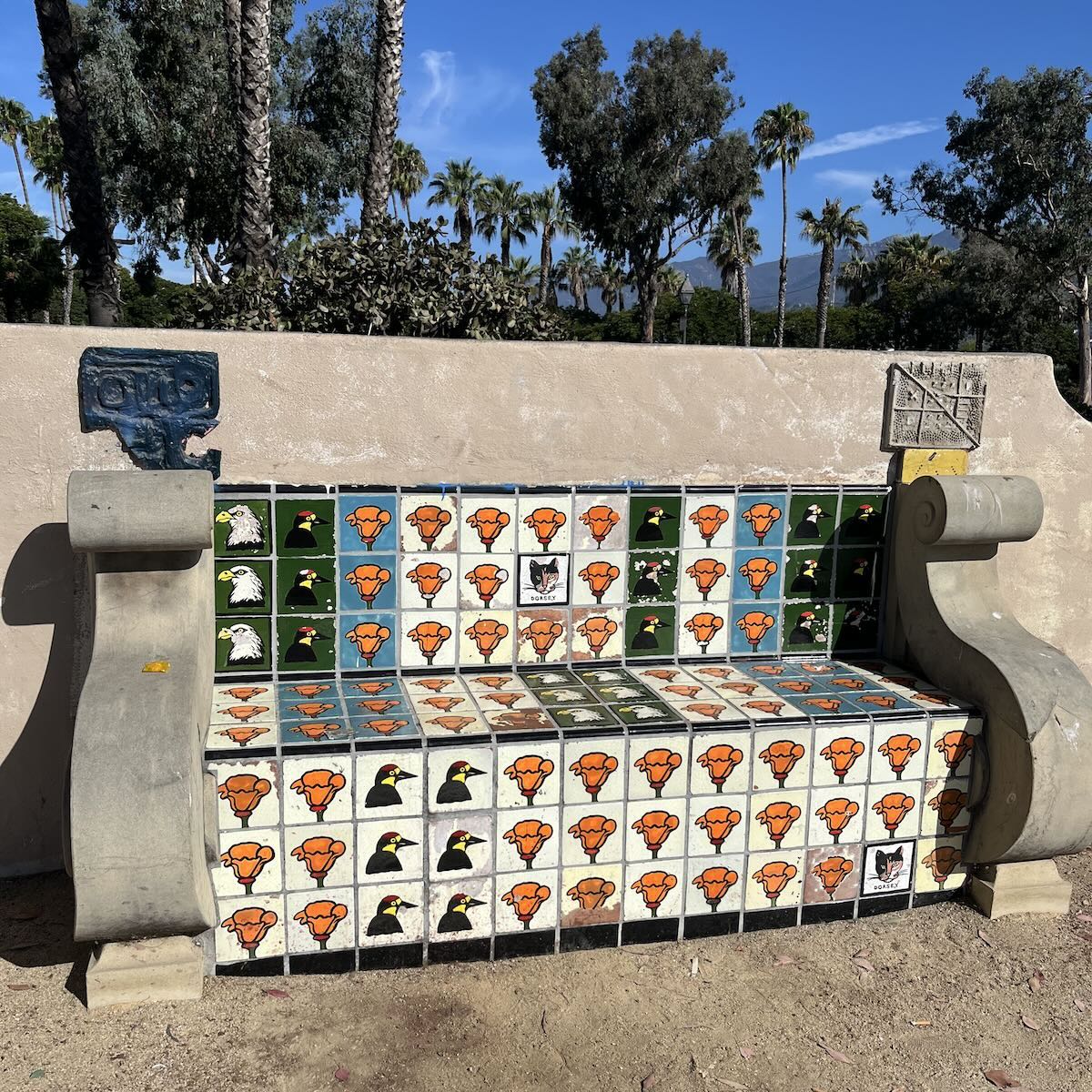
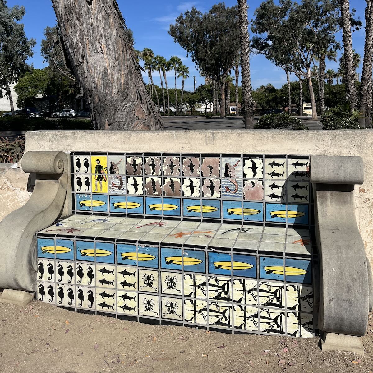
Thanks to this Santa Barbara public art map, I was able to discover that the benches are the work of esteemed local artist Hank Pitcher, and that one is untitled and the other is called Dorsey (as written under the cat in the middle of the first bench below). How they came to be along the Garden Street Lot’s retaining wall is a mystery. “Hank told me they were originally designed and commissioned as part of a much larger development project at that location,” said Nathan Vonk (who co-created the aforementioned map) of Sullivan Goss (which represents Pitcher). “For reasons I can’t remember (or never learned), the rest of the development never happened. There might be a more intriguing story to be uncovered there, but Hank didn’t seem to know it.” I had no luck with the city; anyone know more?
UPDATE: I heard back from the Planning Counter, which pointed out that the benches were added when the restroom building was constructed at the Garden Street Lot, according to a 1999 document about a coastal development permit. There’s no mention of the mosaics, though.
 ················
I’m curious about the large parcel of land at the corner of Garden Street and Yanonali—it appears to be abandoned and dilapidated. What’s going to happen to that land? It’s right near the ocean! —S.
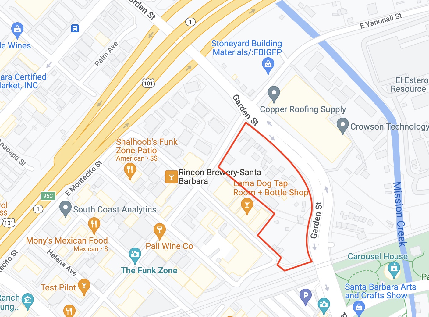
The 4.53-acre parcel (101 Garden Street) at the southwest corner of Garden Street and Yanonali Street is going to be a 250-room hotel. From the city’s description of the project:
Guest amenities include library, bar, lounge, market, media salon, meeting rooms, living room, breakfast area, outdoor seating areas with spa, courtyard with pool and spa, fitness room, and a roof deck. In addition, the hotel development would also include six affordable housing units. Parking would be provided in a subterranean parking garage. The main entrance to the hotel would be from Garden Street, with secondary entrances from East Yanonali and Santa Barbara Streets. The project also includes restoration of the wetland/drainage area and 15-foot-wide buffer area located along the Garden Street frontage.
················
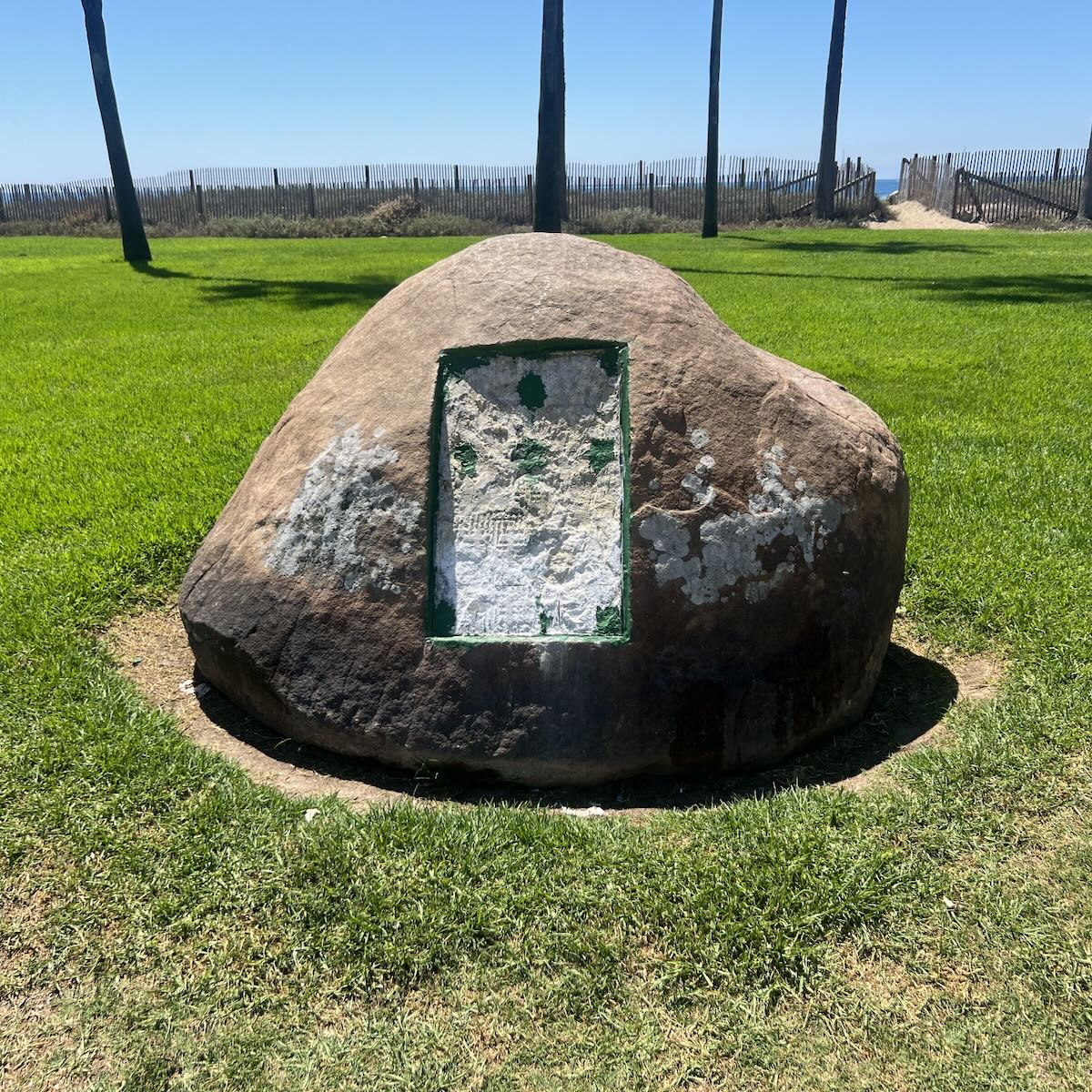
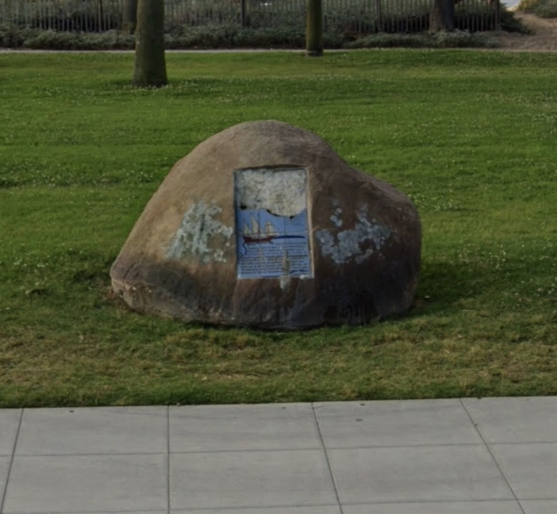
What happened to this plaque in Chase Palm Park, west of Calle Cesar Chavez? And is it getting replaced? —G.
Santa Barbara Parks and Recreation director Jill Zachary says that she’s not sure when the tiles began to deteriorate and either fall out or be removed by passersby. “The memorial had been badly damaged, so we removed the remaining tiles. We’re working on a replacement, but I don’t have a completion date yet.” The second photo is from Google Maps, and there’s a good one on Trip Advisor that shows the text (which commemorates explorer Juan Rodríguez Cabrillo).
 ················
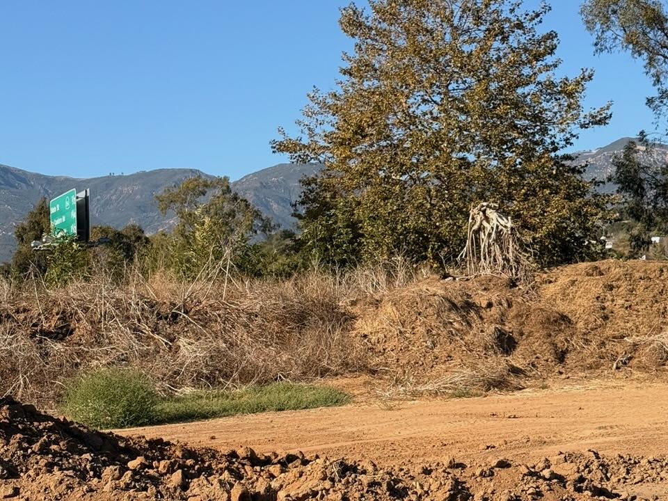
I wonder if you’ve noticed (or are as curious as I am about) the giant, horned, Minotaur-ish wooden sculpture on the ocean side of the 101 south heading into Santa Barbara? I just spotted it a few months ago but there’s no telling how long it’s been there. If you look off to your right heading southbound, right as you’re about to pass the highway sign noting 1/2 mile to 154/State Street exit, you’ll see it poking up over the train tracks. Is this someone’s beloved backyard sculpture? It was notably headless for a few days last month (routine maintenance?) but is now back to full glory. It has to be eight to ten feet tall at least. —C.
This was news to me, and I went looking when I had some time to kill before a meeting. I didn’t see anything, however, that fit the description. When I got home, I asked T., who has a keen eye for the funkier aspects of this area. “L. and I went on a mission to find it. Spotted it from the freeway, by the 1/2 mile to 154 sign. Then checked the Page Youth Center, the cemetery, and the neighborhoods, but no luck. I was thinking at this point it was from a homeless camp, and not visible unless we walked the tracks, which sounded like a really bad idea—kinda like taking a photo from an offramp. [Ahem.] We went back on the freeway and noted it was near a flag and a Norfolk Pine. Then it was easy to find. If you go, it’s visible from the cemetery. It is on the far right (east) and beyond the fence. I would guess it’s a rootball, no more that 4 feet tall, that possibly looks taller from the freeway because you assume there’s more to it hidden from sight. To me, it looks more like an alien out of Neill Blomkamp’s imagination than it does a minotaur.”
 ················
Previous Burning Questions:
••• What are these signs at the San Ysidro roundabout?
••• Can anything be done about biting midges?
••• How come the Gaviota rest areas are closed so often?
••• Why is the Cliff Drive overlook closed?
••• Who installed this security camera in Montecito?
••• Why are the railroad tracks being expanded along Padaro Lane?
••• Will you explain the plan to adapt the waterfront for climate change?
••• Why did the Rosewood Miramar Beach install gates?
••• How long will this big pipe be at East Beach?
••• Is Cabrillo Boulevard going to be widened under Highway 101?
••• Was there a Fisherman Inn in downtown Santa Barbara?
••• What are those old buildings at the corner of Castillo and Montecito streets?
••• What’s this scaffold structure on Las Positas Road?
••• Why does street striping take so long to happen?
••• Why do rocket launches look the way they do?
••• How is the San Ysidro Debris Basin designed to work?
••• What’s this building on Helena Avenue?
••• What are those old pilings in Arroyo Burro Creek?
••• What’s this building under construction in Toro Canyon?
••• What’s the story behind the seal of the City of Santa Barbara?
↓↓↓ Butterfly Beach steps, green power lines, SBAG license plates, and more
••• What’s this pole with a flashing blue light?
••• What are these sculptures on the Riviera?
••• What’s the origin story of this fence on Hot Springs Road?
••• Why is part of this West Beach mosaic covered in concrete?
••• What was the Weeping Willow Inn?
••• What does the “S” on certain chimneys stand for?
••• What’s the status of the decommissioning of Rincon Island?
••• What happened to the gas flame on Highway 101?
••• What do we know about the proposed apartment complex at 1 Hot Springs Road?
••• What’s the history of this tower on Ortega Ridge?
••• What’s up with these sculptures on a hillside in Summerland?
••• Is there a master plan for the new walking paths in Montecito?
••• Why are the Thousand Steps still wet?
••• What’s happening with Sola Street?
••• Why is this lot on Milpas Street still vacant?
••• Where else do cruise ships that visit here go?
••• What is this large memorial in Ennisbrook?
••• Who bought the former St. Mary’s seminary—and why?
••• What will happen to the SBPD building when the new building is completed?
••• What’s the story with this house on W. Cota Street?
••• What are those little houses on Santa Barbara Street?
••• What’s the point of this light pole near the freeway?
••• What’s inside Paseo Nuevo’s State Street tower?
••• What’s the point of these markings on Laguna Street?
••• Why is there a giant red shoe off Highway 101?
••• What’s up with the “no e-bike” signs on local trails?
••• Why is Franceschi House in a holding pattern?
••• What’s happening with this derelict house in Summerland?
••• Can you explain how sundowner winds work?
••• Why is there a pressure cooker attached to this utility pole?
••• What’s this concrete ramp thing on East Beach?
••• Why does “USA” get written on the street?
••• What are those poles in the ocean near the Ritz-Carlton Bacara?
••• Are people really allowed to set fires in the middle of Montecito?
••• What’s the story with the half-finished lot next to the Montecito Country Mart?
 ················
Sign up for the Siteline email newsletter and you’ll never miss a post.










On the 101 garden street vicinity map, note that Rincon brewery announced it was closed at this location, been a while, maps don’t get updated frequently.