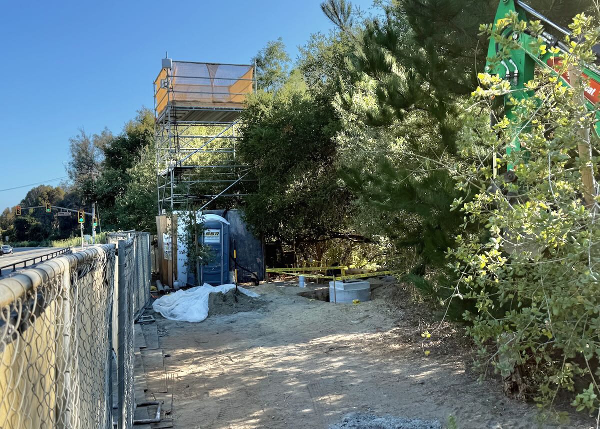
What’s the scaffold structure on Las Positas just north of Veronica Springs Road? There’s communication gear attached to it. —M.
The city of Santa Barbara’s Public Works department said that AT&T is working on a cell site installation there, adding that “The construction is a minor modification of the existing site, and the company is in compliance with its permit to restore the public right of way upon completion. The scaffolding is necessary to safely perform the work.”
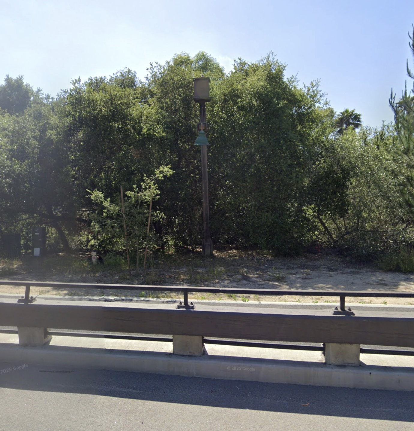
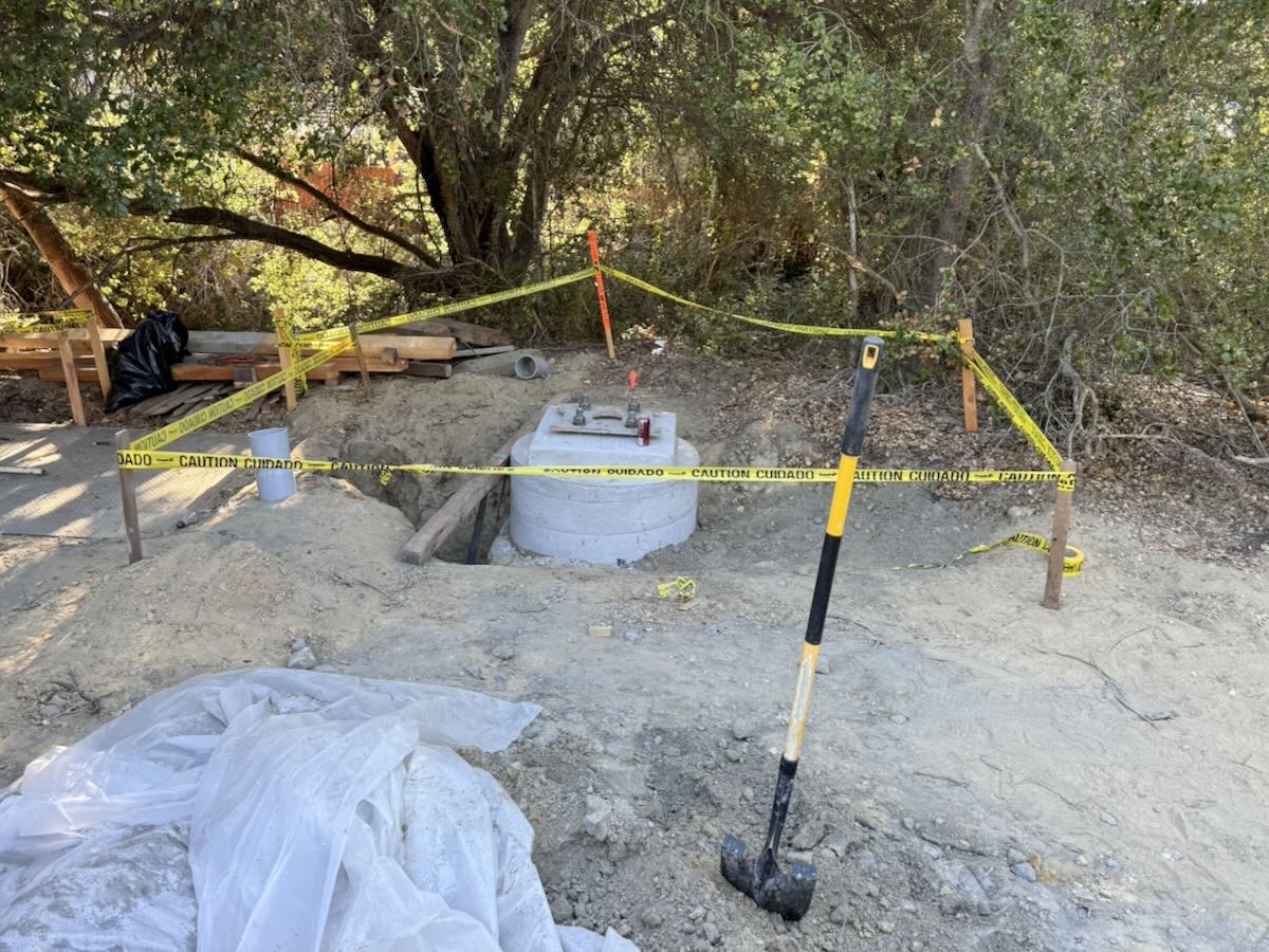
As to finding out how long the work might take (it’s blocking the multi-use path) and why exactly the scaffold tower is necessary, Public Works directed me to an AT&T rep, who said the company expects to be done with the scaffold no later than September 19. When I asked again about its purpose, however, I got a non-answer. (“The scaffolding allows our workers to make improvements to the facility approved by the City in November of 2024.”) So let’s deduce: according to Google Maps, there was a utility pole at that site (below), so it seems likely that the tower is supporting temporary communication equipment while a new pole (second photo below) is constructed.
 Got a question you’d like investigated? Email [email protected] or text 917-209-6473.
················
Previous Burning Questions:
••• Why does street striping take so long to happen?
••• Why do rocket launches look the way they do?
••• How is the San Ysidro Debris Basin designed to work?
↓↓↓ What’s this building on Helena Avenue?
••• What are those old pilings in Arroyo Burro Creek?
••• What’s this building under construction in Toro Canyon?
••• What’s the story behind the seal of the City of Santa Barbara?
••• Butterfly Beach steps, green power lines, SBAG license plates, and more
••• What’s this pole with a flashing blue light?
••• What are these sculptures on the Riviera?
••• What’s the origin story of this fence on Hot Springs Road?
••• Why is part of this West Beach mosaic covered in concrete?
••• What was the Weeping Willow Inn?
••• What does the “S” on certain chimneys stand for?
••• What’s the status of the decommissioning of Rincon Island?
••• What happened to the gas flame on Highway 101?
••• What do we know about the proposed apartment complex at 1 Hot Springs Road?
••• What’s the history of this tower on Ortega Ridge?
••• What’s up with these sculptures on a hillside in Summerland?
••• Is there a master plan for the new walking paths in Montecito?
••• Why are the Thousand Steps still wet?
••• What’s happening with Sola Street?
••• Why is this lot on Milpas Street still vacant?
••• Where else do cruise ships that visit here go?
••• What is this large memorial in Ennisbrook?
••• Who bought the former St. Mary’s seminary—and why?
••• What will happen to the SBPD building when the new building is completed?
••• What’s the story with this house on W. Cota Street?
••• What are those little houses on Santa Barbara Street?
••• What’s the point of this light pole near the freeway?
••• What’s inside Paseo Nuevo’s State Street tower?
••• What’s the point of these markings on Laguna Street?
••• Why is there a giant red shoe off Highway 101?
••• What’s up with the “no e-bike” signs on local trails?
••• Why is Franceschi House in a holding pattern?
••• What’s happening with this derelict house in Summerland?
••• Can you explain how sundowner winds work?
••• Why is there a pressure cooker attached to this utility pole?
••• What’s this concrete ramp thing on East Beach?
••• Why does “USA” get written on the street?
••• What are those poles in the ocean near the Ritz-Carlton Bacara?
••• Are people really allowed to set fires in the middle of Montecito?
••• What’s the story with the half-finished lot next to the Montecito Country Mart?
 ················
Sign up for the Siteline email newsletter and you’ll never miss a post.


Why didn’t you take a better close-up photo of that Rattlesnake?