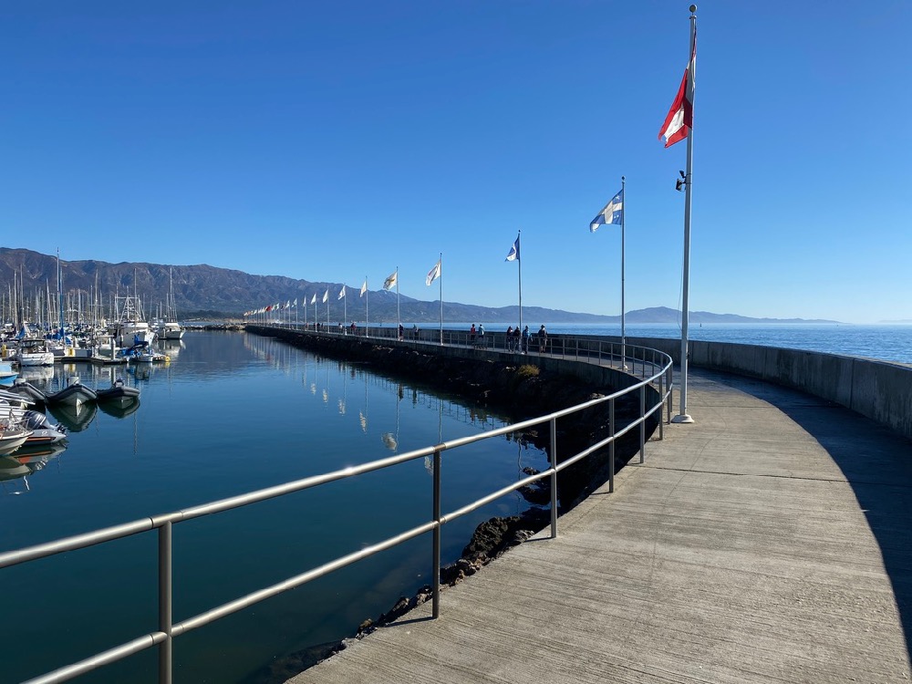
I’d like to raise something that your readers may be interested in: the city’s newly released Waterfront Adaptation Plan. While State Street plans have been of immediate interest, the city has just released a long-term (30-year) plan for the waterfront, including Leadbetter Beach, the harbor, and East Beach. Due to an anticipated rise in sea level of up to several feet, plans are now afoot to, among other things, add new breakwaters (“pedestrian walkways”), move parking to a structure, and add new facilities at the harbor. The plans are accessible here, where there is also a public survey available until May 18. —T.
That wasn’t technically a question, but let’s pretend that T. is asking me to simplify the proposals for easier digestion.
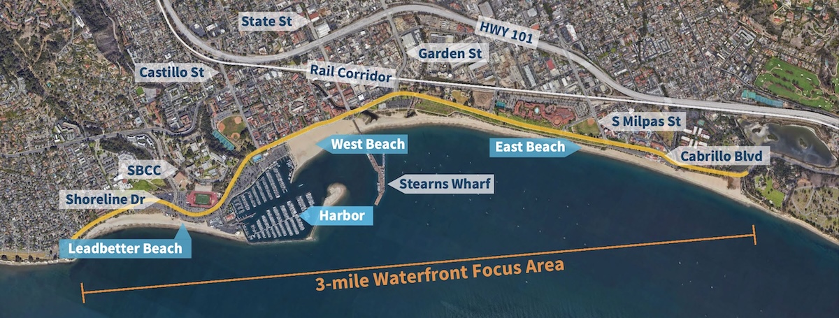
The plan comes from the Adaptation & Resilience Division of the city’s Sustainability & Resilience Department, with the goal to “develop practical solutions to address coastal flooding and erosion for the next 30 years, while enhancing beach access, recreation, boating, and habitat” from Leadbetter Beach to East Beach.
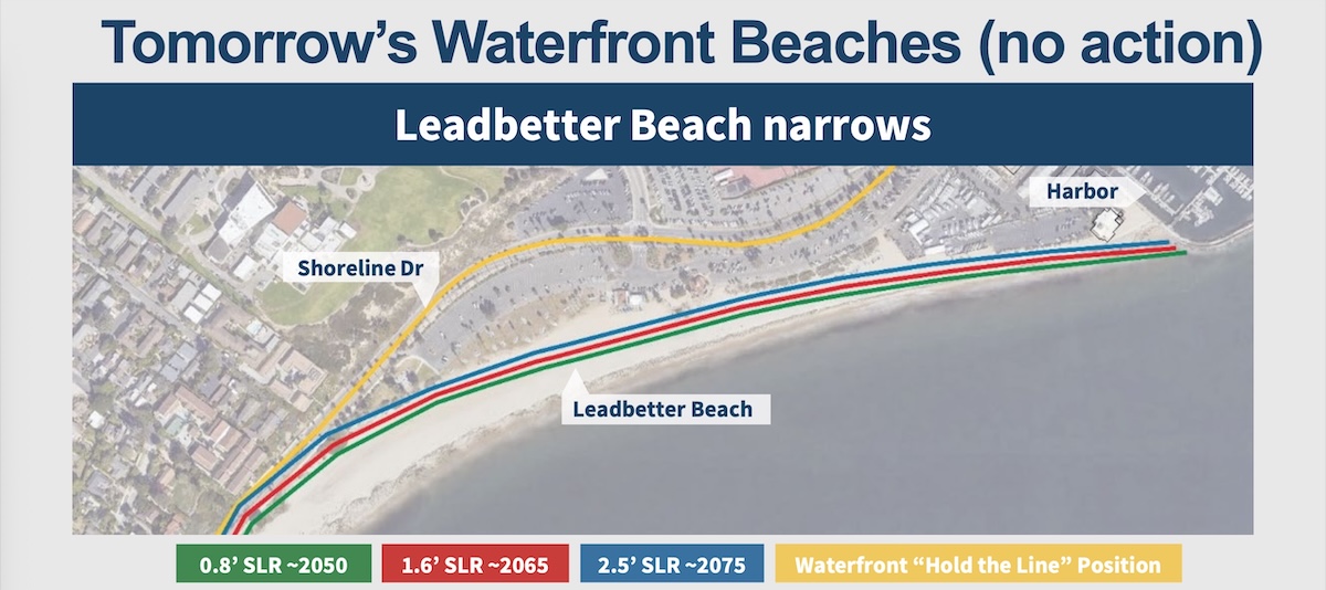
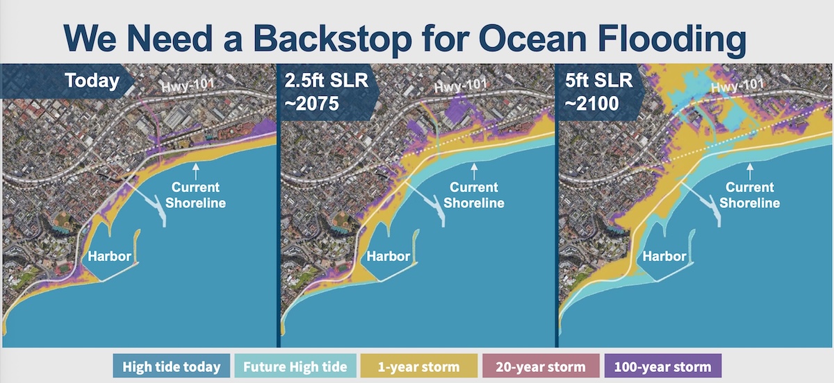
 If we do nothing, Leadbetter Beach and East Beach face erosion.
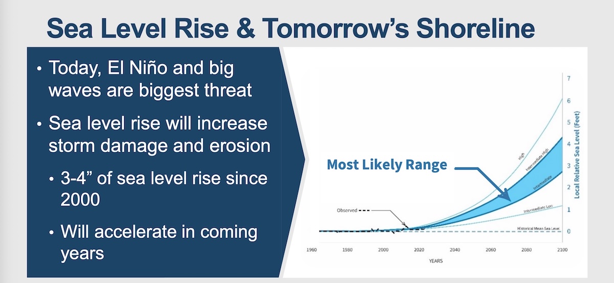
 And flooding becomes a real possibility.
 Three classes of solutions are proposed. In order of expense, from low to high:
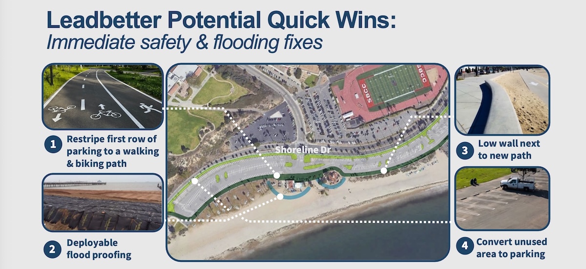
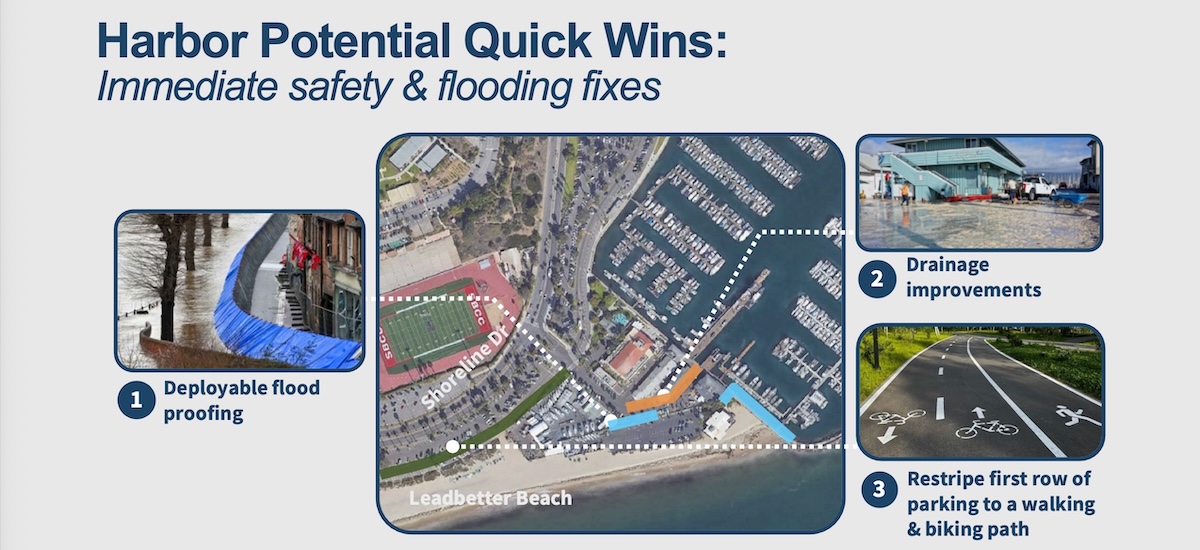
1) Quick wins: “Quick-to-implement, low-cost actions to address pressing safety and flooding issues now, such as temporary deployable flood barriers, drainage improvements, and restriping parking lots to provide a safe place to walk and bike.” (A safe place to walk and bike sounds great, but not exactly pertinent to climate adaptation.)
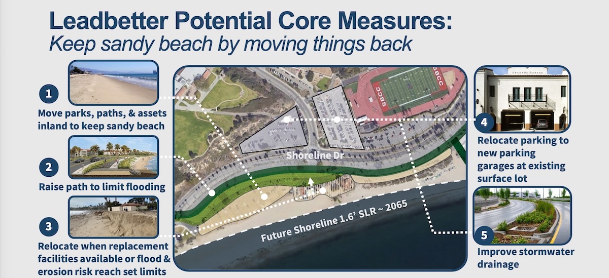
2) Core measures: “Large projects that comprehensively address flooding, erosion, and access issues for at least 30 years,” such as:
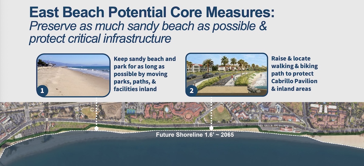
—Strategically relocating some features at Leadbetter and East Beach inland, including parking, restrooms, paths, park areas, to protect and preserve them and create space for wide sandy beaches.
—Adding sand, berms, and dunes to build up and maintain wide sandy beach areas.
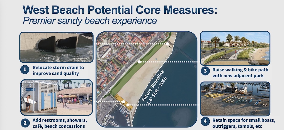
—Upgrading West Beach with better stormwater drainage to improve sand quality and adding amenities such as restrooms and showers to make it a premier beach destination.
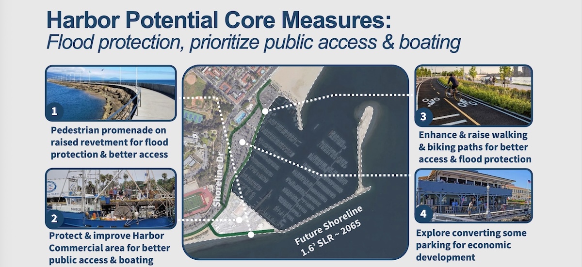
—Protecting the Harbor Commercial Area with a revetment topped with a pedestrian promenade to reduce flooding and erosion and improve public access between the Harbor and Leadbetter Beach.
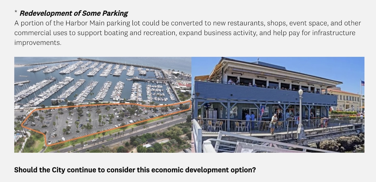
—Improving the Harbor Commercial Area by expanding services for boating and commercial uses, increasing public access, and creating new revenue opportunities to help fund Waterfront improvements.
—Creating a safe, continuous, and separated walking and biking path along the entire Waterfront that is gradually elevated to protect the path and inland areas from flooding.
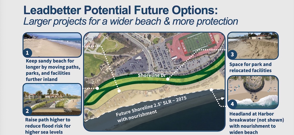
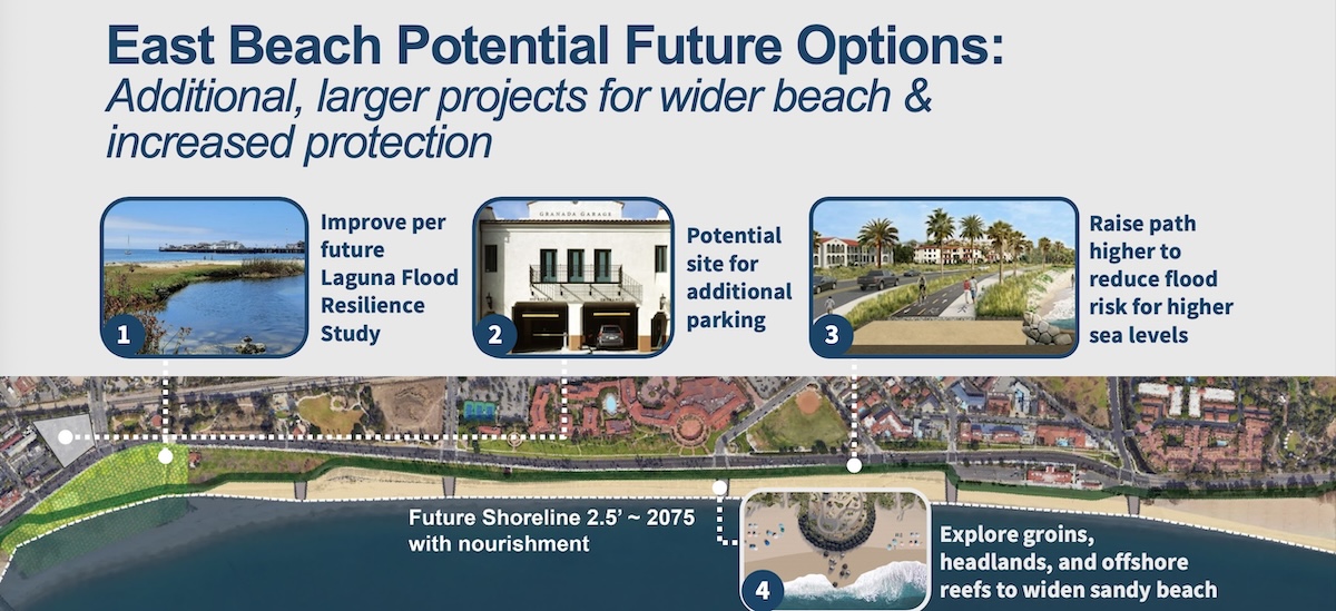
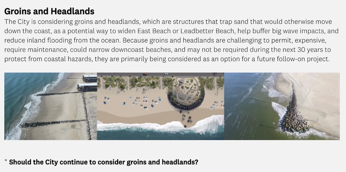
3) Future options: “Largest-scale, highest-cost projects that would address flooding and erosion at higher amounts of sea level rise, beyond 30 years,” such as:
—Raising the walking and biking path higher to provide more flood protection for inland areas.
—Moving paths, parks, and facilities further inland to create more space for wide sandy beaches.
—Adding groins, headlands, and offshore reefs to retain sand and widen beaches.
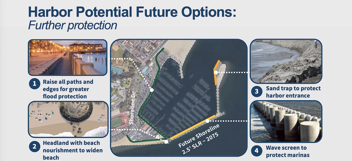
—Protecting the Harbor Marinas by raising the breakwater and installing wave screens.
Here’s how each class of solution might apply to Leadbetter Beach. Don’t overlook #4 in the second slide, where there’s talk of building a parking structure on the lot near SBCC.
 And for the harbor:
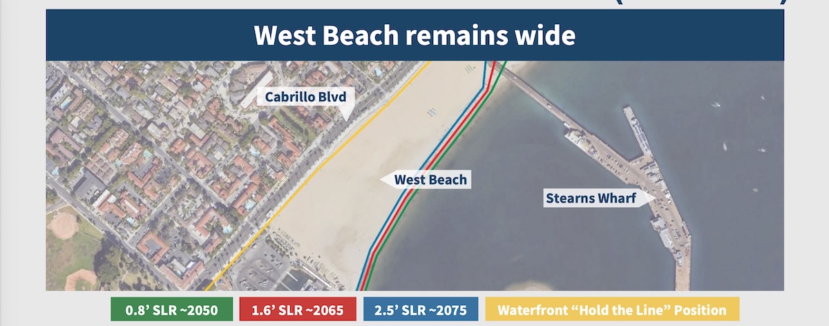
 For West Beach, only core measures (the middle category) are raised as a possibility:
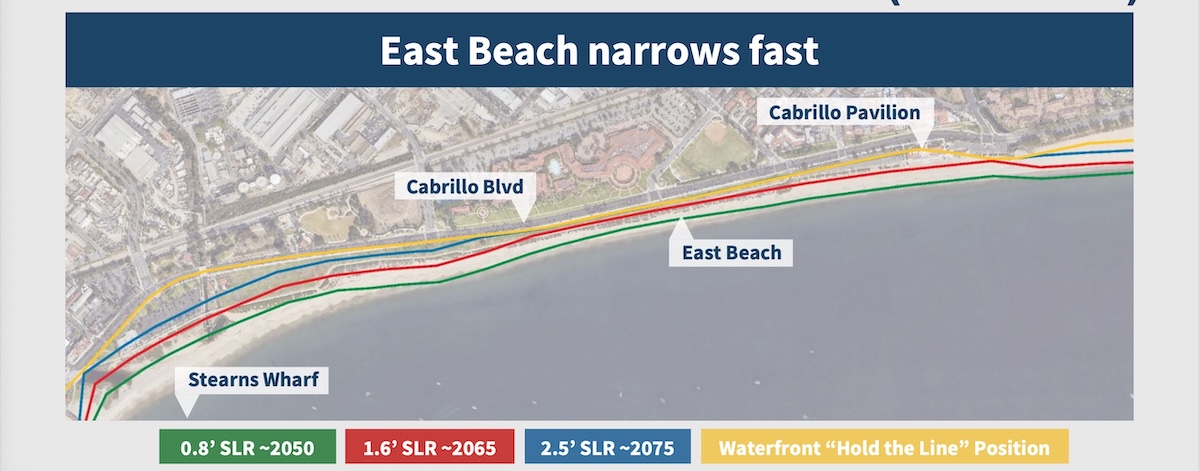
 And East Beach has no quick fixes:
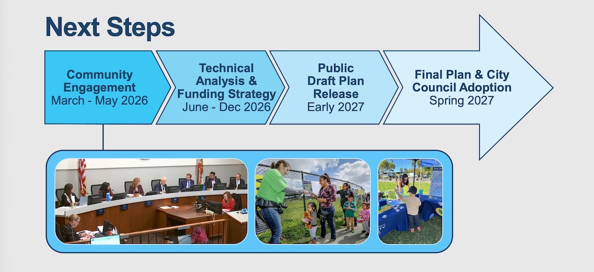
 As you might expect, changing anything at the waterfront takes time, and this is the beginning of a long process.
 The survey mentioned at top is here. It’s more interested in how you feel about certain solutions than expecting you to suggest something new. That said, a couple of the questions could be controversial. For instance….
 And then there’s the possibility of developing the parking at the harbor. Personally, I think we should only pursue this kind of thing if there’s a way to curate for quality. And I know this will be unpopular, but perhaps the city could charge much more than $145 for an annual waterfront parking permit. At that price, it’s basically being given away.
 Is there a question you’d like investigated? Email [email protected] or text 917-209-6473.
················
Previous Burning Questions:
••• Why did the Rosewood Miramar Beach install gates?
••• How long will this big pipe be at East Beach?
••• Is Cabrillo Boulevard going to be widened under Highway 101?
••• Was there a Fisherman Inn in downtown Santa Barbara?
••• What are those old buildings at the corner of Castillo and Montecito streets?
••• What’s this scaffold structure on Las Positas Road?
••• Why does street striping take so long to happen?
••• Why do rocket launches look the way they do?
••• How is the San Ysidro Debris Basin designed to work?
••• What’s this building on Helena Avenue?
••• What are those old pilings in Arroyo Burro Creek?
••• What’s this building under construction in Toro Canyon?
••• What’s the story behind the seal of the City of Santa Barbara?
••• Butterfly Beach steps, green power lines, SBAG license plates, and more
••• What’s this pole with a flashing blue light?
••• What are these sculptures on the Riviera?
••• What’s the origin story of this fence on Hot Springs Road?
↓↓↓ Why is part of this West Beach mosaic covered in concrete?
••• What was the Weeping Willow Inn?
••• What does the “S” on certain chimneys stand for?
••• What’s the status of the decommissioning of Rincon Island?
••• What happened to the gas flame on Highway 101?
••• What do we know about the proposed apartment complex at 1 Hot Springs Road?
••• What’s the history of this tower on Ortega Ridge?
••• What’s up with these sculptures on a hillside in Summerland?
••• Is there a master plan for the new walking paths in Montecito?
••• Why are the Thousand Steps still wet?
••• What’s happening with Sola Street?
••• Why is this lot on Milpas Street still vacant?
••• Where else do cruise ships that visit here go?
••• What is this large memorial in Ennisbrook?
••• Who bought the former St. Mary’s seminary—and why?
••• What will happen to the SBPD building when the new building is completed?
••• What’s the story with this house on W. Cota Street?
••• What are those little houses on Santa Barbara Street?
••• What’s the point of this light pole near the freeway?
••• What’s inside Paseo Nuevo’s State Street tower?
••• What’s the point of these markings on Laguna Street?
••• Why is there a giant red shoe off Highway 101?
••• What’s up with the “no e-bike” signs on local trails?
••• Why is Franceschi House in a holding pattern?
••• What’s happening with this derelict house in Summerland?
••• Can you explain how sundowner winds work?
••• Why is there a pressure cooker attached to this utility pole?
••• What’s this concrete ramp thing on East Beach?
••• Why does “USA” get written on the street?
••• What are those poles in the ocean near the Ritz-Carlton Bacara?
••• Are people really allowed to set fires in the middle of Montecito?
••• What’s the story with the half-finished lot next to the Montecito Country Mart?
 ················
Sign up for the Siteline email newsletter and you’ll never miss a post.


Any mention of Sterns Wharf besides a pointer marking it on your top slide? With sea level rise waves could reach the bottom of the Wharf on a routine basis during a spring storm.
It is insane that a city with only 88k people has a department filled with professionals who are paid to come up with this stuff.
Also insane that people actually think the oceans are going to rise several feet in the next few decades and the most important issues we face from this global catastrophe is whether we should move bike paths and toilets facilities.
The city has lost its way and its mind.
This stuff is not the business of a city of 88k people. This kind of stuff is why the city is broke and falling further and further into debt. Trying to predict the outcome of rising oceans which will impact all 8billion people on earth, so that our parks and rec department can forecast revenue and budgeting? What the actual F????
Meanwhile, every student of SB history knows that the real coastal destruction is from the current location of the breakwater / harbor and the best thing we could do to fix coastal erosion is to move the breakwater and the harbor. But no. Let’s try and plan for and engineer a solution to a problem that may or may not happen over decades while our city falls apart today. Awesome work city of SB! You’re doing a heck of a job.