
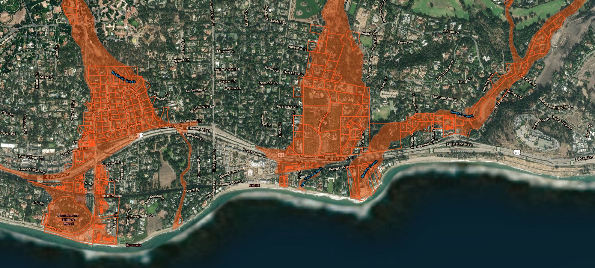
The new Storm Impact Consideration Map is live. Go there if you want to check a specific address. But here’s a general overview, with screenshots. According to the Montecito Journal, nearly 1,000 properties have been removed from the red zone—good news for the owners and the real-estate market in general. (It’ll be interesting to see whether more properties get listed as a result.) For more info on the map, there’s a meeting tonight at 5:30 p.m. at Montecito Union School, or you can watch it online. [UPDATE: I should’ve clarified that the county and fire department are calling this a Storm Impact Consideration Map, rather than a Debris Flow Risk Map, as it was previously known, and that they say it won’t be used to decide who gets evacuated. That’s some solace for the 517 parcels still in the red zone.]
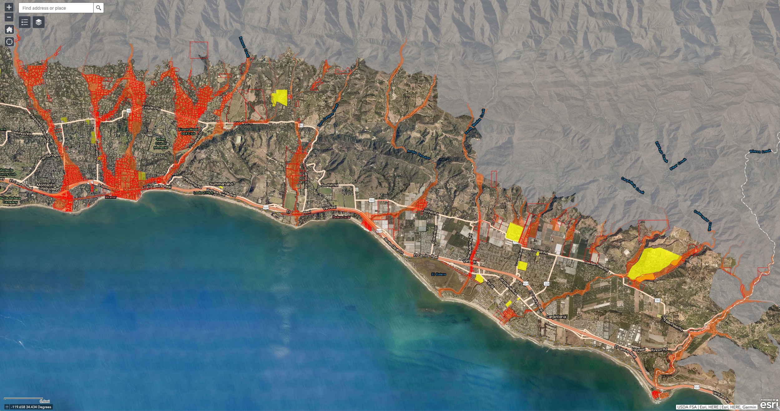
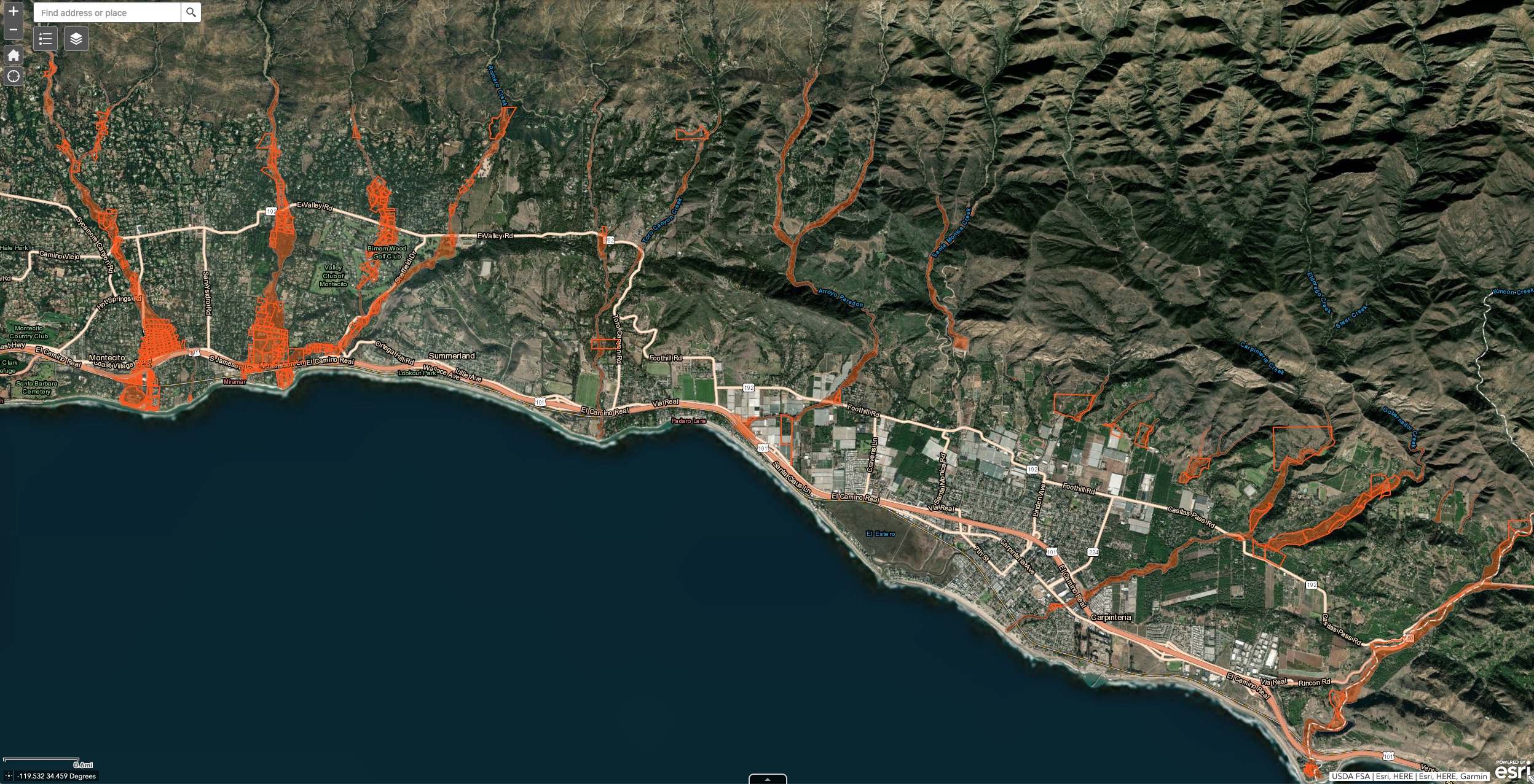
The December 2018 map and the new one, showing Montecito and Carpinteria:
 Zooming in, here’s Montecito, old and new:

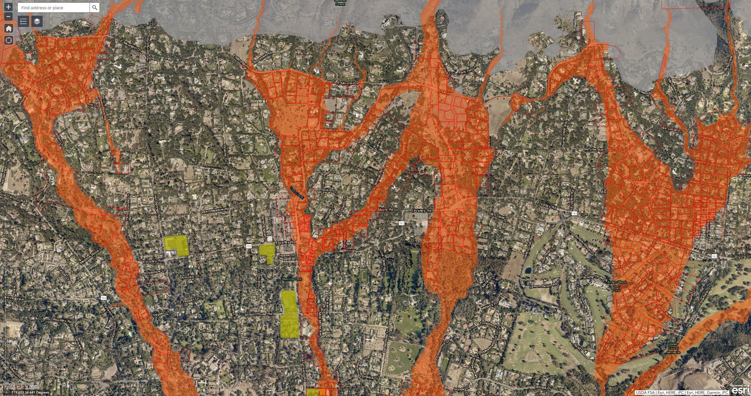
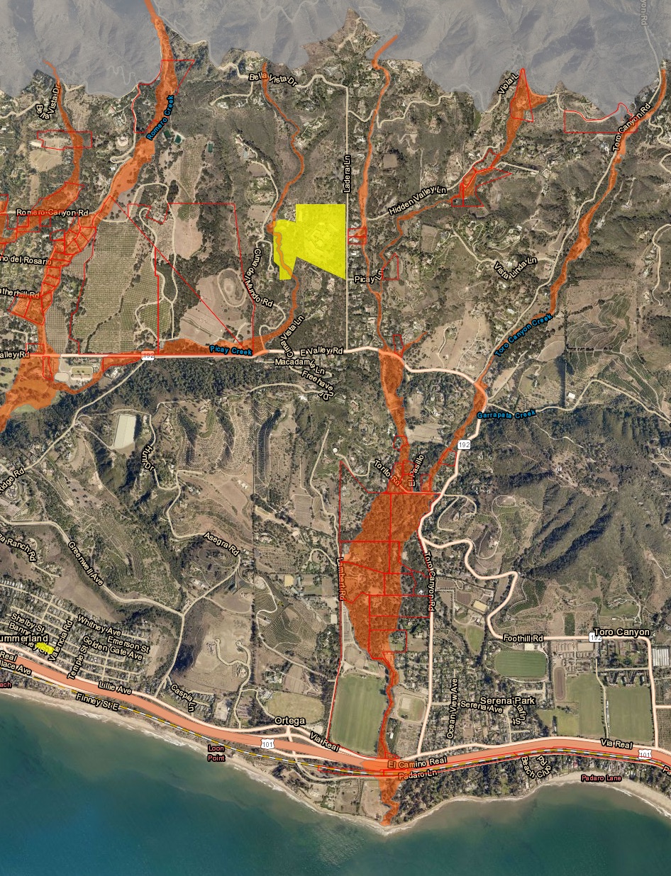
 A closer look at upper Montecito:
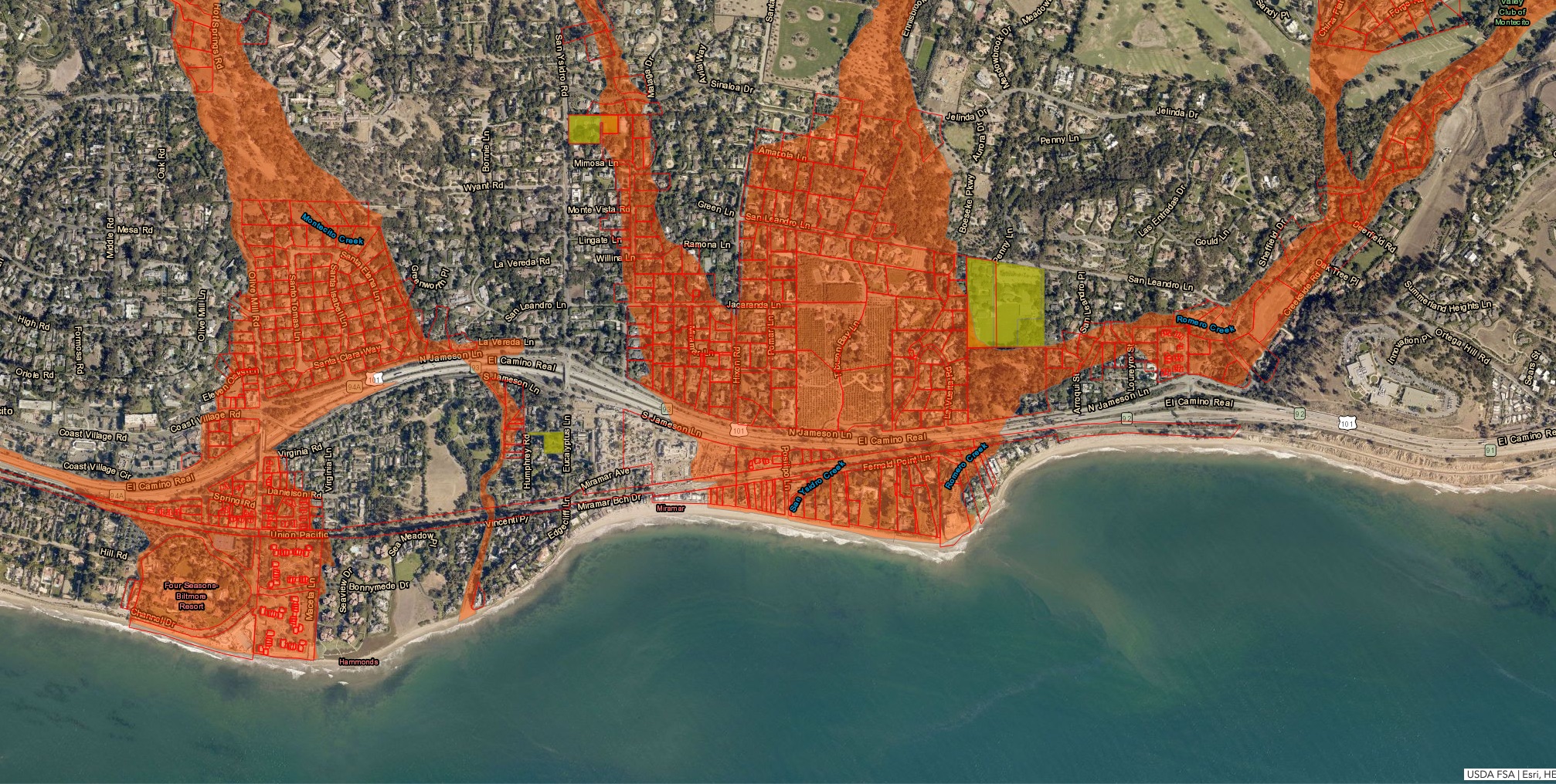
 And lower Montecito, old and new:
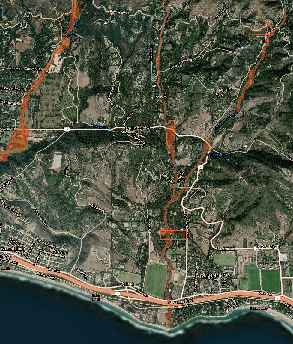
 Finally, western Montecito:


Comment: